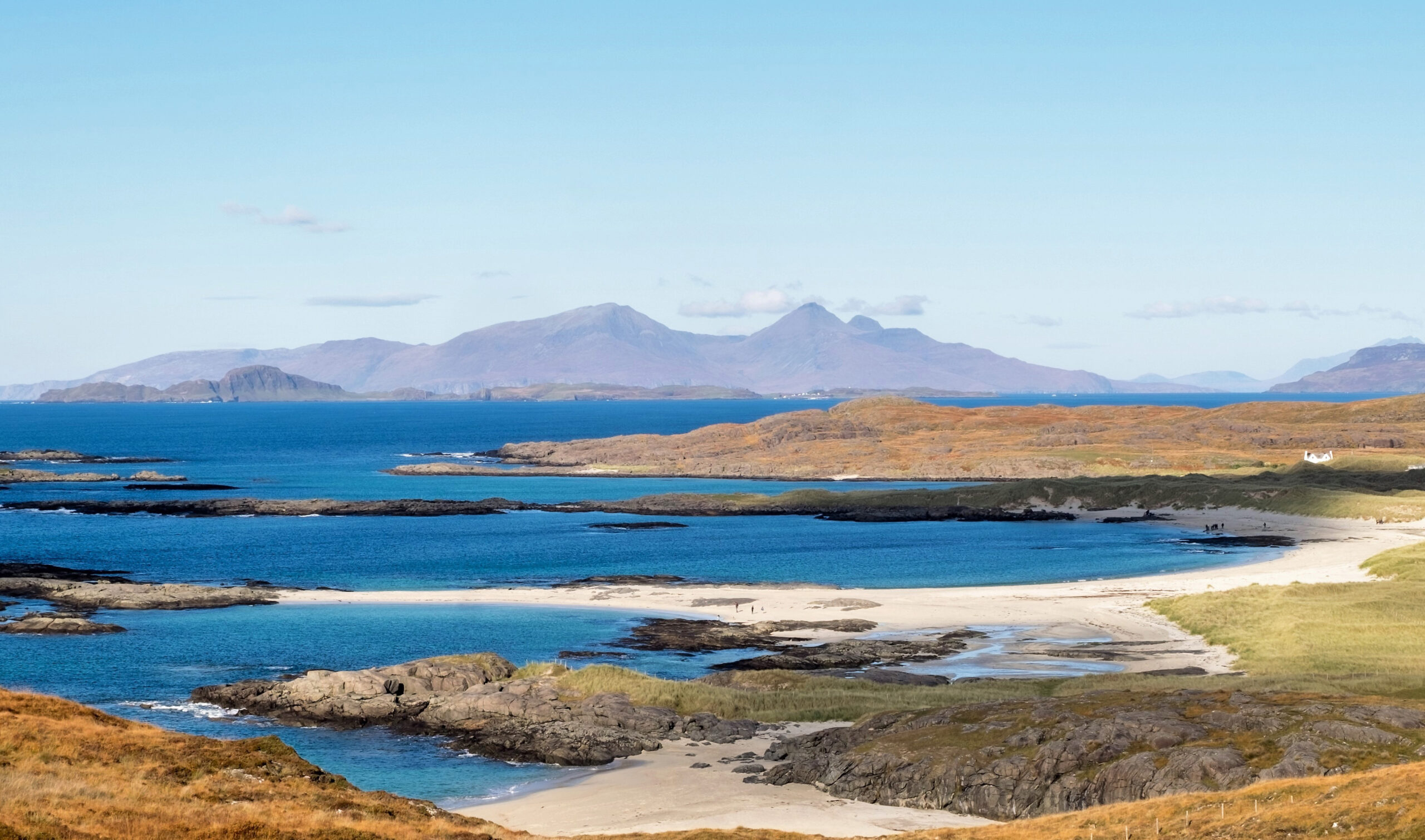

Scotland has well over 10,000 miles of coastline once you count the islands. White-sand bays in the Hebrides, cliff paths in the Borders, fishing villages in Fife, sea stacks in Orkney and Caithness, and puffin cliffs in Shetland, all stitched together by long-distance trails and short coastal strolls.
Here are 100 of the best coastal walks in Scotland – mapped – from East Neuk village hops to the far north of Shetland. For each one you’ll find the distance, how hard it is, what not to miss and where to eat.
My favourite coastal walks in Scotland
- For a long weekend: the Fife Coastal Path
- For white sand: Sanna Bay, Ardnamurchan
- Most remote: Sandwood Bay
- For puffins: Sumburgh Head, Shetland
- For a sea stack: the Old Man of Hoy
- On Skye: Neist Point
- With kids: St Abbs to Coldingham
- Near Edinburgh: North Berwick to Tantallon
- Near Glasgow: Dunure to Culzean
- For dolphins: Chanonry Point
- For an adventure: the Elie Chain Walk
- Most extreme: Cape Wrath
100 of the best Scotland coastal walks map
100 coastal walks, from village hops on the Fife coast to the puffin cliffs of Shetland. Pick a region to zoom in, then tap a pin or a walk in the list to jump to it.
Scotland
Pick a region to zoom ·
tap a pin to jump to the walk
- St Abbs and Coldingham Bay Read about this walkDirections
- Dunbar to Barns Ness Read about this walkDirections
- North Berwick to Tantallon Read about this walkDirections
- Yellowcraig and Fidra Read about this walkDirections
- Aberlady Bay to Gullane Point Read about this walkDirections
- Cramond Island Read about this walkDirections
- Kinneil to Blackness Castle Read about this walkDirections
- Culross to Preston Island Read about this walkDirections
- Aberdour to Burntisland Read about this walkDirections
- Kirkcaldy to Dysart Read about this walkDirections
- Elie Chain Walk Read about this walkDirections
- Elie to St Monans, Fife Coastal Path Read about this walkDirections
- St Monans to Pittenweem Read about this walkDirections
- Anstruther to Crail Read about this walkDirections
- Crail to Kingsbarns Read about this walkDirections
- St Andrews to the Rock and Spindle Read about this walkDirections
- Tentsmuir Ice House Trail Read about this walkDirections
- Arbroath Cliffs to Auchmithie Read about this walkDirections
- Lunan Bay Read about this walkDirections
- St Cyrus Read about this walkDirections
- Stonehaven to Dunnottar Castle Read about this walkDirections
- Newburgh seal beach Read about this walkDirections
- Cruden Bay to the Bullers of Buchan Read about this walkDirections
- Gardenstown to Crovie Read about this walkDirections
- Sandend to Portsoy Read about this walkDirections
- Bow Fiddle Rock, Portknockie Read about this walkDirections
- Findhorn to Hopeman Read about this walkDirections
- Mull of Galloway Read about this walkDirections
- St Ninian’s Cave Read about this walkDirections
- Portpatrick to Dunskey Castle Read about this walkDirections
- Rockcliffe to Kippford Read about this walkDirections
- Dunure to Culzean Castle Read about this walkDirections
- Portencross Castle Read about this walkDirections
- Tighnabruaich and the Kyles of Bute Read about this walkDirections
- Carradale Point, Kintyre Read about this walkDirections
- Davaar Island, Kintyre Read about this walkDirections
- Mull of Kintyre lighthouse Read about this walkDirections
- Machrihanish Bay, Kintyre Read about this walkDirections
- Isle of Kerrera Read about this walkDirections
- Sanna Bay from Portuairk Read about this walkDirections
- Silver Sands of Morar Read about this walkDirections
- Kinloch Hourn to Barrisdale Read about this walkDirections
- Plockton shore walk Read about this walkDirections
- Applecross to Sand Read about this walkDirections
- Red Point, Gairloch Read about this walkDirections
- Achmelvich and the Hermit’s Castle Read about this walkDirections
- Old Man of Stoer Read about this walkDirections
- Handa Island Read about this walkDirections
- Sandwood Bay Read about this walkDirections
- Cape Wrath Read about this walkDirections
- Balnakeil Bay to Faraid Head Read about this walkDirections
- Smoo Cave, Durness Read about this walkDirections
- Ceannabeinne Township Trail Read about this walkDirections
- Ard Neakie, Loch Eriboll Read about this walkDirections
- Talmine and Achininver beaches Read about this walkDirections
- Castle Varrich, Tongue Read about this walkDirections
- Strathy Point Read about this walkDirections
- Holborn Head, Scrabster Read about this walkDirections
- Dunnet Head Read about this walkDirections
- John o’ Groats to Duncansby Stacks Read about this walkDirections
- Whaligoe Steps Read about this walkDirections
- Badbea clearance village Read about this walkDirections
- Golspie to Brora Read about this walkDirections
- Dornoch beach to Embo Read about this walkDirections
- Tarbat Ness Read about this walkDirections
- Cromarty and McFarquhar’s Bed Read about this walkDirections
- Chanonry Point, Black Isle Read about this walkDirections
- King’s Cave, Arran Read about this walkDirections
- Sannox to Lochranza (Cock of Arran) Read about this walkDirections
- Isle of Gigha twin beaches Read about this walkDirections
- Mull of Oa, Islay Read about this walkDirections
- Machir Bay, Islay Read about this walkDirections
- Kiloran Bay, Colonsay Read about this walkDirections
- Iona marble quarry Read about this walkDirections
- Carsaig Arches, Mull Read about this walkDirections
- Calgary Bay, Mull Read about this walkDirections
- Tiree: the Ringing Stone Read about this walkDirections
- Singing Sands, Eigg Read about this walkDirections
- Point of Sleat, Skye Read about this walkDirections
- Boreraig and Suisnish, Skye Read about this walkDirections
- Elgol to Camasunary, Skye Read about this walkDirections
- Talisker Bay, Skye Read about this walkDirections
- Neist Point, Skye Read about this walkDirections
- Coral Beach, Skye Read about this walkDirections
- Rubha Hunish, Skye Read about this walkDirections
- Vatersay beaches, Barra Read about this walkDirections
- Berneray West Beach Read about this walkDirections
- Huisinis, Harris Read about this walkDirections
- Luskentyre, Harris Read about this walkDirections
- Gearrannan to Dalbeg, Lewis Read about this walkDirections
- Butt of Lewis Read about this walkDirections
- Old Man of Hoy Read about this walkDirections
- Yesnaby cliffs, Orkney Read about this walkDirections
- Marwick Head, Orkney Read about this walkDirections
- Brough of Birsay, Orkney Read about this walkDirections
- Sumburgh Head, Shetland Read about this walkDirections
- St Ninian’s Isle, Shetland Read about this walkDirections
- Isle of Noss, Shetland Read about this walkDirections
- Eshaness cliffs, Shetland Read about this walkDirections
- Hermaness, Unst Read about this walkDirections
walks showing
Pins mark the start or the heart of each walk. Where pins sit close together, a short line points to the exact spot. Many island walks need a ferry, and some ferries only run in spring and summer, so check before you set off.
Is there a coastal path around Scotland?
No. Unlike Wales and England, which both have a coast path running around their whole coastline, Scotland has no single continuous coastal path.
Instead, there’s a network of waymarked coastal trails, most of them part of Scotland’s Great Trails. The John o’ Groats Trail (147 miles), the Fife Coastal Path (117 miles), the Ayrshire Coastal Path (around 100 miles), the Kintyre Way (100 miles), the Moray Coast Trail (50 miles) and the Berwickshire Coastal Path (30 miles) are the main ones. You’ll find all of them in the long-distance coastal paths section below.
On the Highland and island coasts, there’s usually no waymarked path at all. You’re walking on old footpaths, stalkers’ tracks and open ground, thanks to Scotland’s right to roam under the Scottish Outdoor Access Code.
Coastal walks near Edinburgh and Glasgow
No car? Several of the best walks below are an easy day trip from Scotland’s two biggest cities. Journey times are approximate.
Coastal walks near Edinburgh
- Cramond Island: 20 minutes by bus from the city centre
- Kinneil to Blackness Castle: 30 minutes’ drive
- Aberdour to Burntisland: 35 minutes by train to Aberdour
- Dunbar to Barns Ness: 20 minutes by train to Dunbar
- Kirkcaldy to Dysart: 45 minutes by train to Kirkcaldy
- Yellowcraig and Fidra: 40 minutes by car, or bus via Dirleton
- North Berwick to Tantallon Castle: 35 minutes by train to North Berwick
- Aberlady Bay to Gullane Point: 40 minutes by bus or car
- St Abbs and Coldingham Bay: 1 hour’s drive
- The East Neuk of Fife: 1 hour 15 minutes’ drive
- The Elie Chain Walk: 1 hour 15 minutes’ drive
Coastal walks near Glasgow
- Portencross Castle: 1 hour by car, or train to West Kilbride
- Dunure to Culzean Castle: 1 hour’s drive
- The King’s Cave, Arran: Train to Ardrossan, ferry to Brodick, then bus
- Sannox to Lochranza, Arran: Train to Ardrossan, ferry to Brodick, then bus
- Tighnabruaich and the Kyles of Bute: 2 hours’ drive, or via the Gourock to Dunoon ferry
- The Isle of Kerrera: Train to Oban, then the Kerrera ferry
Edinburgh, Fife and the Borders
Here are my favourite coastal walks in Fife, near Edinburgh and the Scottish Borders.
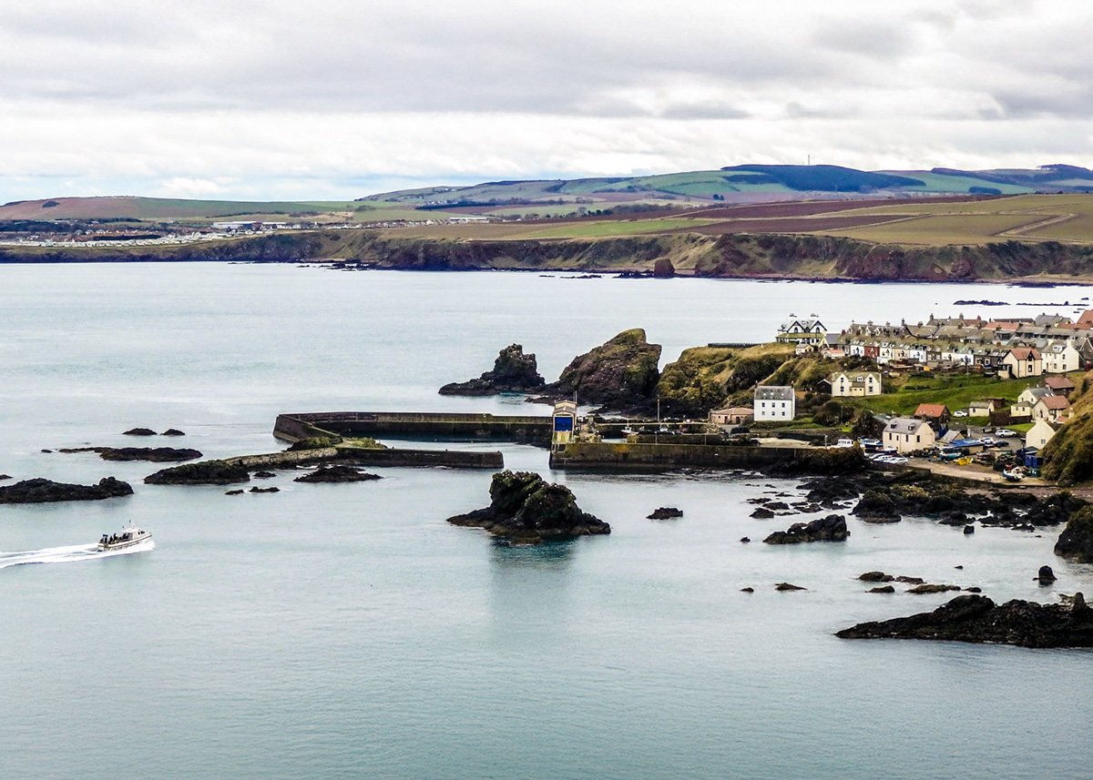
St Abbs and Coldingham Bay on the Berwickshire Coastal Path
The Berwickshire Coastal Path runs 30 miles from Cockburnspath to Berwick-upon-Tweed in England, and links up with both the Southern Upland Way and the John Muir Way at Cockburnspath. From the pretty village of St Abbs, you can walk south along the clifftop to Coldingham Bay or north through the St Abbs Head Nature Reserve.
Coldingham Sands is a gorgeous beach lined with colourful beach huts and famous for its surfing. It’s about 1.5 miles along the cliff path from St Abbs.
Heading north, the cliff path through St Abbs Head leads to the unusually named Pettico Wick Bay. Here you can see folded rocks and 400-million-year-old pink and purple volcanic lava, which form ledges for thousands of nesting seabirds.
For lunch, grab a locally caught crab sandwich at Ebb Carr’s Cafe, and pop into the Visitor Centre to find out more about the area.
Distance: 3 miles return to Coldingham Bay · Difficulty: Easy to moderate · Best for: seabirds, geology, families with older children · Don’t miss: the volcanic rocks at Pettico Wick, surfing at Coldingham · Where to eat: Ebb Carr’s Cafe, St Abbs
Visit St Abbs and find more things to do in the Scottish Borders. Walk the Creel Path to St Abbs and Coldingham Bay.
Dunbar to Barns Ness, East Lothian
Dunbar is the birthplace of John Muir, the Scots-born father of America’s national parks, and the eastern end of the John Muir Way. From the ruined castle by the harbour, follow the coast east through the John Muir Country Park, along the edge of Belhaven Bay and out to Barns Ness lighthouse.
The limestone shore here is full of fossils, and the White Sands beach just beyond the lighthouse is one of the quietest on the East Lothian coast. Dunbar is only 20 minutes from Edinburgh by train.
Distance: about 8 miles return · Difficulty: Easy · Best for: a car-free day, fossils, lighthouses · Don’t miss: Barns Ness lighthouse · Where to eat: Dunbar
Find out more at johnmuirway.org. Walk the John Muir Link from Dunbar past Barns Ness.
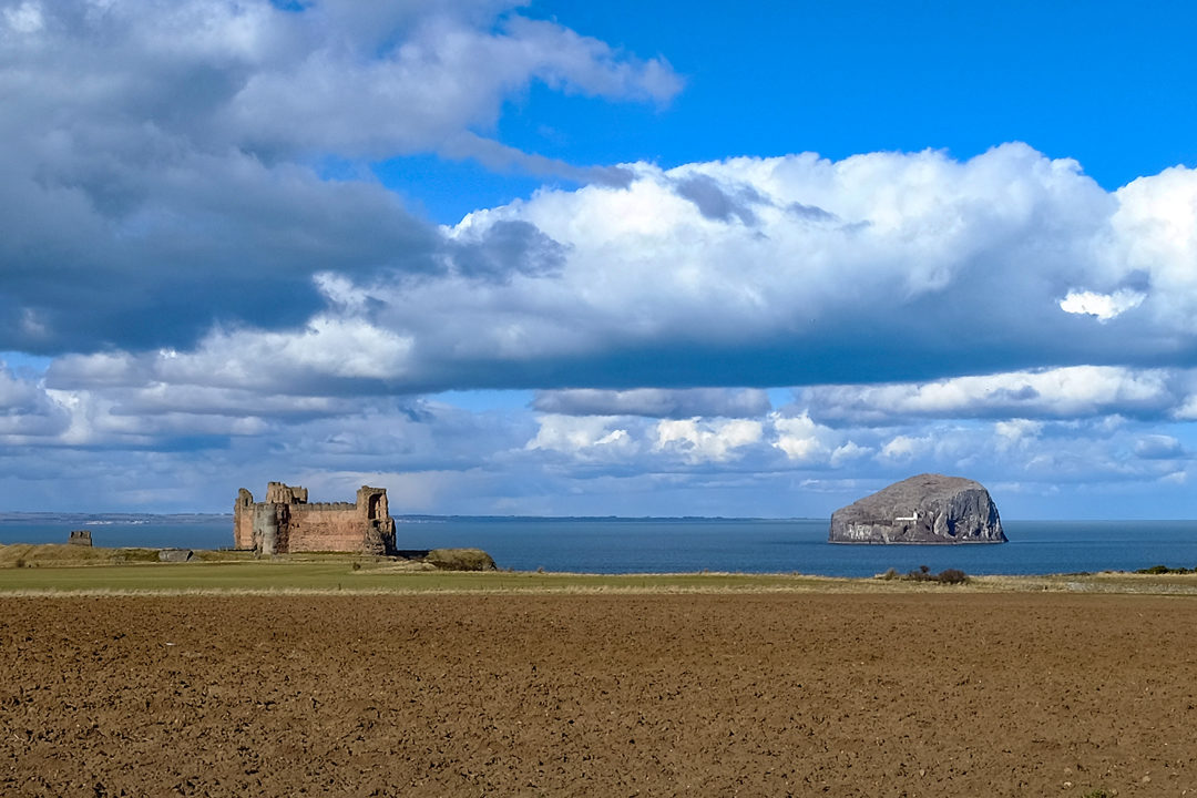
North Berwick to Tantallon Castle, East Lothian
A short, easy and dramatic walk from the seaside town of North Berwick to one of Scotland’s most spectacular castle ruins. The path follows the John Muir Way along the clifftops with constant views of the Bass Rock, the world’s largest northern gannet colony. It ends at the red sandstone ruins of Tantallon Castle, perched on the cliff opposite the rock.
This is the easiest “wow factor” coastal walk near Edinburgh, and North Berwick is only 35 minutes by train from the city. You can extend it by walking on to Seacliff Beach, one of the best beaches in East Lothian.
Distance: 3 miles one way, 6 miles return · Difficulty: Easy · Best for: an easy day from Edinburgh, castles, gannets · Don’t miss: the Bass Rock, the cliff approach to Tantallon · Where to eat: the Lobster Shack on North Berwick harbour (seasonal), the Drift Cafe.
Walk from North Berwick to Tantallon.
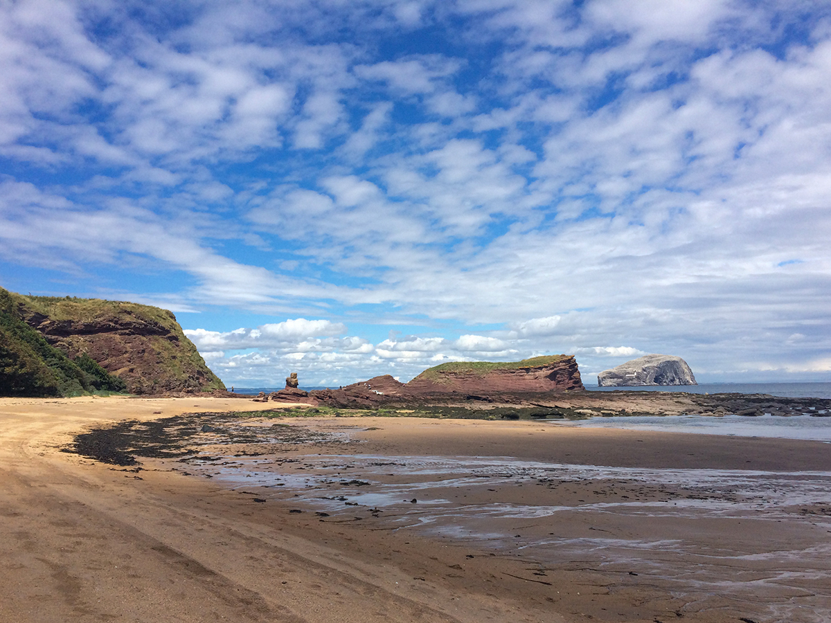
Yellowcraig and Fidra, East Lothian
A perfect family walk just west of North Berwick. From the Yellowcraig car park near Dirleton, paths lead through woodland and dunes to a lovely sandy beach looking out to Fidra, a little island with a lighthouse that’s said to have inspired Robert Louis Stevenson’s Treasure Island.
Loop back along the beach and through the dunes. There’s a Treasure Island-themed play park by the car park, and Dirleton Castle is just down the road.
Distance: about 2.5 miles circular · Difficulty: Easy · Best for: families, beaches, dog walks · Don’t miss: the view to Fidra · Where to eat: Dirleton or North Berwick
Walk the Yellowcraig beach circuit from Dirleton.
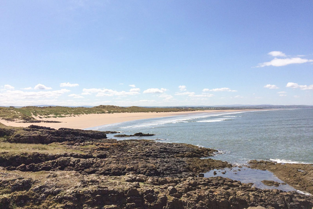
Aberlady Bay to Gullane Point, East Lothian
Aberlady Bay was the UK’s first Local Nature Reserve, a wide tidal bay of salt marsh, mudflats and dunes a few miles west of North Berwick. Cross the wooden footbridge from the car park and follow the path through the dunes to the coast and Gullane Point, then return along the beach and Gullane Bents.
In winter the bay fills with pink-footed geese. At low tide you can spot the wrecks of two Second World War midget submarines out on the sands, but check the tide times and don’t walk out to them on a rising tide.
Distance: about 6 miles return · Difficulty: Easy · Best for: birdwatching, big beaches, an easy day from Edinburgh · Don’t miss: the geese in winter, the view back across the bay · Where to eat: The Golf Inn, Gullane, The Leddie, Aberlady.
Walk from Aberlady Bay to Gullane Point.
Cramond Island, Edinburgh
A tidal island you can walk to from the edge of Edinburgh. At low tide a mile-long causeway runs out across the sands from Cramond village, past a line of Second World War anti-boat pylons, to a small uninhabited island scattered with wartime gun emplacements and bunkers.
The views take in the Forth bridges, Fife and the Edinburgh skyline. Cramond village is worth a wander too, with its whitewashed cottages and the remains of a Roman fort by the church.
Check the tide before you go. The causeway is only safe for roughly two hours either side of low tide, and the RNLI rescues people cut off here every year. Safe crossing times are posted at the start of the causeway, published by Queensferry RNLI, or you can text CRAMOND to 81400. Never try to wade back on a rising tide.
Distance: 1 mile each way across the causeway, plus the island · Difficulty: Easy, but tidal · Best for: a short escape from the city, wartime history · Don’t miss: the anti-boat pylons along the causeway · Where to eat: the Cramond Inn.
Walk to Cramond Island.
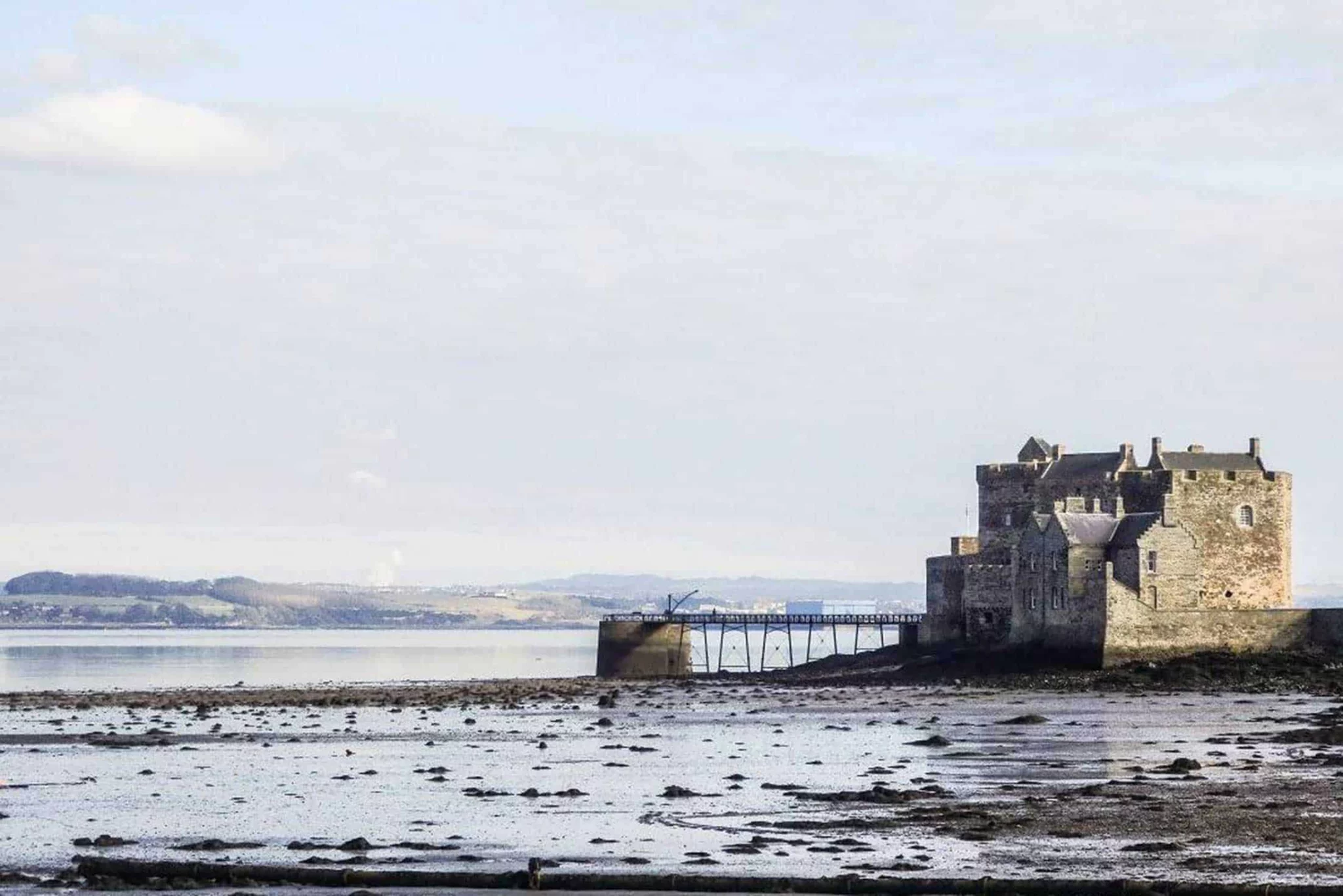
Blackness Castle on the Firth of Forth
Blackness Castle is no pretty palace. It’s a fortress, built in the 1440s to guard the royal port of Linlithgow, and later a state prison. In 1650 it was besieged and badly damaged by Oliver Cromwell’s army.
It’s known as “the ship that never sailed” because it looks like a boat from the water, and the views across the Forth to Fife are superb. Outlander fans will recognise it as Fort William, Black Jack Randall’s headquarters.
You can reach Blackness Castle on foot along the John Muir Way from Kinneil to Blackness. This section is 6.5 miles (10.5 km) one way, passing Kinneil Nature Reserve before reaching the coast at Bo’ness. Stop for lunch at the Lobster Pot in Blackness before heading back.
Distance: 6.5 miles / 10.5 km one way · Difficulty: Easy · Best for: an easy day from Edinburgh, Outlander fans · Don’t miss: Blackness Castle · Where to eat: the Lobster Pot, Blackness
Walk from Kinneil to Blackness.
Culross to Preston Island, Fife
Culross (pronounced “coo-ris”) is one of Scotland’s best-preserved and prettiest 17th-century villages, with cobbled streets and ochre-coloured houses. Outlander fans will recognise it as the village of Cranesmuir.
From the village, walk east along the Shore Road on the coast of West Fife to Preston Island, where the remains of early 19th-century salt pans and a colliery stand beside the Forth. It’s an easy, flat walk with big views over the firth.
Distance: about 3 miles return · Difficulty: Easy, flat · Best for: history, Outlander fans, an easy stroll · Don’t miss: Culross Palace · Where to eat: The Mercat, Culross.
Walk past Culross on the Fife Coastal Path from Kincardine to North Queensferry.
Aberdour to Burntisland, Fife
A short and easy section of the Fife Coastal Path that starts and finishes at a railway station, so you can leave the car at home. From Aberdour, with its castle and harbour, the path climbs over Hawkcraig Point and drops to Silver Sands, one of the best beaches on the Forth.
Beyond the beach, the path runs beside the railway, past a pretty waterfall, with views across the water to Inchcolm Abbey and the Edinburgh skyline, before reaching Burntisland. Take the train back.
Distance: about 3.5 miles one way · Difficulty: Easy (one steep flight of steps) · Best for: a car-free day, families, beaches · Don’t miss: Silver Sands · Where to eat: the café at Silver Sands
Walk from Aberdour to Burntisland on the North Queensferry to Burntisland stage.
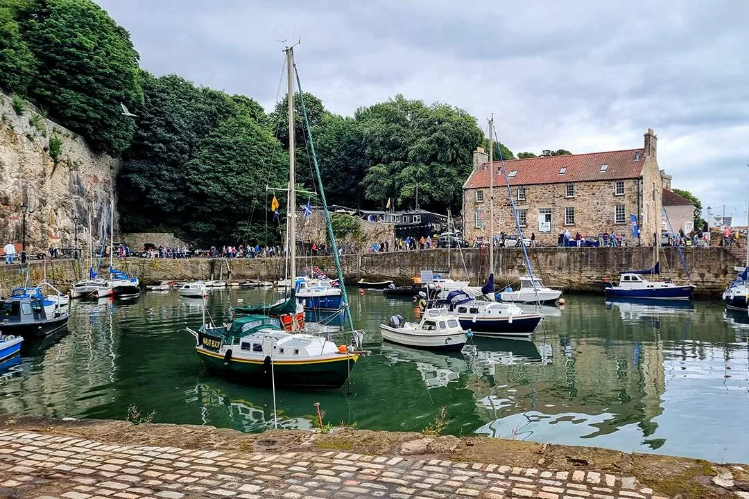
Kirkcaldy to Dysart, Fife
Catch the train to the bustling town of Kirkcaldy and follow the Fife Coastal Path along the promenade and through Ravenscraig Park, past the ruins of Ravenscraig Castle on its clifftop, to Dysart with its hidden gem of a harbour.
Dysart’s harbour is lined with restored 16th and 17th-century houses, and it’s one of the prettiest corners of the Fife coast, yet few visitors find it. It’s a short, easy walk and perfect without a car.
Distance: about 2 miles one way · Difficulty: Easy · Best for: a car-free day out, history · Don’t miss: Dysart harbour · Where to eat: Dysart or Kirkcaldy
Walk from Kirkcaldy to Dysart on the Burntisland to East Wemyss stage.
The Elie Chain Walk, Fife
The most adventurous half-mile on the Fife Coastal Path. Between Earlsferry and Kincraig Point, a series of chains, footholds and ladders is fixed into the cliffs, letting you clamber along the rocks at the foot of the headland. It’s a proper scramble, and great fun with confident older children.
Most people combine it with the clifftop path over Kincraig Point, where there are Second World War gun batteries and views across the Forth, to make a circular walk from Elie or Earlsferry.
Only attempt the Chain Walk at low tide, and in dry weather. Check tide times before you set off, allow at least an hour for the chains section, and take the clifftop path instead if you’re in any doubt. It isn’t suitable for dogs or young children. Read my full guide to the Elie Chain Walk.
Distance: about 4 miles circular from Elie, including the half-mile of chains · Difficulty: Moderate, with sections of scrambling · Best for: adventure, older kids · Don’t miss: the chains below Kincraig Point · Where to eat: the Ship Inn at Elie
Read my guide to the Elie Chain Walk.
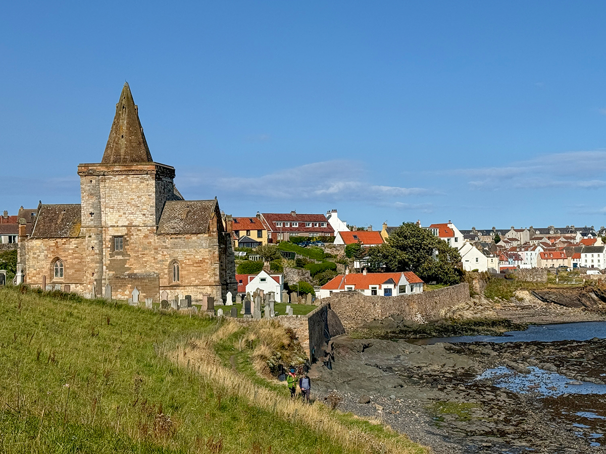
Elie to St Monans on the Fife Coastal Path
The Fife Coastal Path runs 117 miles from Kincardine on the Firth of Forth all the way round to Newburgh on the Firth of Tay. The best way to walk it is in sections, and my favourites link the fishing villages of the East Neuk.
Start in Elie, where you can grab lunch at the Ship Inn, right on the beach. You might even spot a game of cricket being played on the sand. The path passes the striking Elie Lighthouse and Lady’s Tower at Sauchar Point, a changing room built for Lady Anstruther in the 1700s so she could bathe in the Forth, before reaching the ruined and slightly spooky Newark Castle and the little harbour at St Monans.
Distance: about 3 miles one way · Difficulty: Easy, mostly flat · Best for: village hopping, seafood, families · Don’t miss: Lady’s Tower · Where to eat: the Ship Inn at Elie
Walk from Elie to St Monans on the Lower Largo to St Monans stage and find more of the best walks in Fife.
St Monans to Pittenweem, Fife
A short, easy hop between two East Neuk villages. Leaving St Monans, the path passes the St Monans windmill, a relic of the salt panning industry that once dotted this coast, and the remains of the salt pans themselves on the shore below.
Pittenweem is still a working fishing harbour, and its name means “the place of the cave”: St Fillan’s Cave, tucked away in a close off the high street, was once used by the saint himself. For lunch try the East Pier Smokehouse in St Monans, or coffee and cake at the Diving Gannet.
Distance: about 1.5 miles one way · Difficulty: Easy · Best for: a short stroll, families · Don’t miss: the St Monans windmill · Where to eat: the East Pier Smokehouse, St Monans
Walk from St Monans to Pittenweem and Anstruther.
Anstruther to Crail, Fife
Anstruther is the biggest of the East Neuk villages and home to some of Scotland’s most famous fish and chips. From here the path visits Cellardyke and its tiny 16th-century harbour, Skinfast Haven, once home to more than 50 herring boats.
Further on, the path passes the Caves of Caiplie, used as an early site of Christian worship, before arriving in Crail, my favourite of all the East Neuk villages, with its picture-perfect harbour. The return walk from Anstruther to Crail is around 10 miles, or catch the bus back.
Distance: about 5 miles one way, 10 miles return · Difficulty: Easy · Best for: harbours, history, seafood · Don’t miss: the Caves of Caiplie · Where to eat: Anstruther Fish Bar, or the Lobster Hut in Crail (check it’s open)
Walk from Anstruther to Crail.
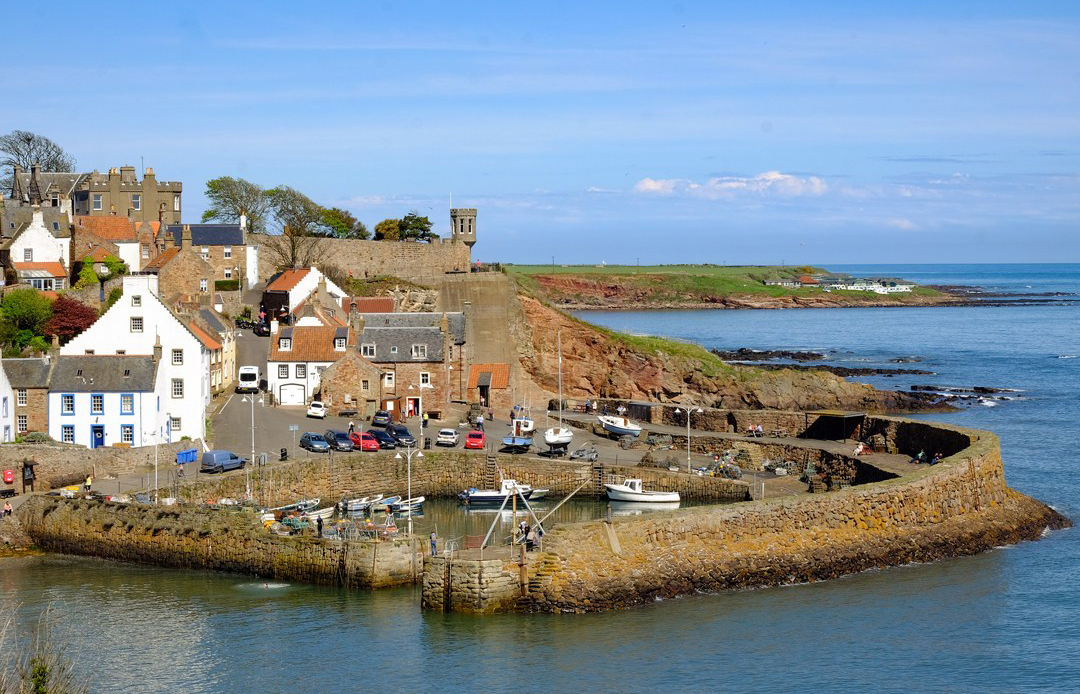
Crail to Kingsbarns, Fife
This is my favourite Fife coastal walk. Crail is my favourite of all the East Neuk villages, but leave it behind to walk out along the furthest eastern point of the Fife Coastal Path, round Fife Ness, to the beautiful beach at Kingsbarns and its famous golf course.
Beyond Crail the coast feels wilder, with rocky shores, seals on the skerries and big skies over the North Sea. Some sections cross rocks and sand, so it’s easier on a falling tide. Catch the bus back to Crail.
Distance: about 7 miles one way · Difficulty: Easy to moderate (rocky in places) · Best for: quiet coast, seals, a sandy finish · Don’t miss: Fife Ness · Where to eat: Crail before you set off
Walk from Crail to Kingsbarns.
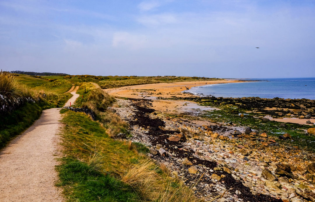
St Andrews to the Rock and Spindle, Fife
From the East Sands in St Andrews, the Fife Coastal Path climbs onto the cliffs above the town and follows the coast east to the Rock and Spindle, a strange volcanic sea stack with a wheel of columnar rock on its side, like a spinning wheel.
On the way back you get one of the best views of St Andrews, with the cathedral ruins and harbour laid out below. The path is unsurfaced with some ups and downs, and you’ll need a lower tide to get close to the rock itself.
Distance: 3.5 miles (5.6 km), almost circular · Difficulty: Easy to moderate · Best for: geology, views of St Andrews · Don’t miss: the Rock and Spindle · Where to eat: St Andrews
Walk to the Rock and Spindle from St Andrews.
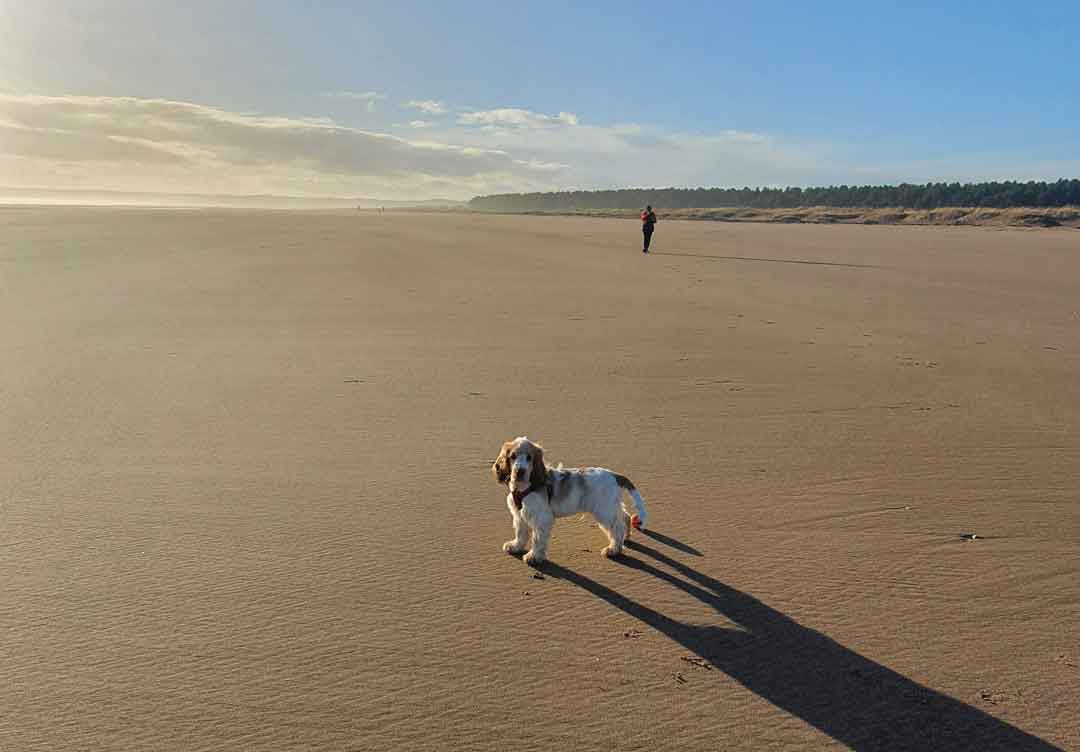
Tentsmuir Beach and Forest, Fife
Tentsmuir is a huge sweep of beach, dunes and pine forest in north-east Fife, just north of St Andrews at the mouth of the Tay. Wild walks on the dunes, a beach big enough for any dog, and a forest full of walking and cycling trails. Tentsmuir is gorgeous.
The neighbouring Tentsmuir National Nature Reserve is home to hundreds of grey and common seals, and thousands of eider ducks and pink-footed geese in winter. You might even spot a bottlenose dolphin.
The Ice House Trail takes you through the dunes and forest to a 19th-century ice house and Second World War pillboxes. It’s 3.75 miles (6 km) and takes around 2 hours. Grab lunch from the crêpe van at the car park.
Distance: 3.75 miles / 6 km · Difficulty: Easy · Best for: seals, dogs, families · Don’t miss: the WWII pillboxes, the seals on the sandbar · Where to eat: the crêpe van at Tentsmuir car park
Visit Tentsmuir Forest and Beach. There’s a charge for the car park. Walk through Tentsmuir Forest and dunes.
Angus, Aberdeenshire and Moray
Arbroath Cliffs to Auchmithie, Angus
Arbroath’s red sandstone cliffs are some of the most dramatic on Scotland’s east coast. The Arbroath Cliffs Nature Trail leaves the northern edge of the town and follows the clifftops past sea stacks, caves and arches with names like the Deil’s Heid and the Needle’s E’e.
Carry on north along the coast to the tiny clifftop village of Auchmithie, where the Arbroath smokie is said to have been invented before the fishing families moved to Arbroath. Seabirds nest on the ledges in early summer.
Distance: about 4 miles one way to Auchmithie · Difficulty: Easy to moderate · Best for: sea arches, geology, seabirds · Don’t miss: the Deil’s Heid sea stack · Where to eat: an Arbroath smokie, bought hot from a smokehouse by the harbour
Find more things to do in Angus. Walk the Seaton Cliffs to Auchmithie.
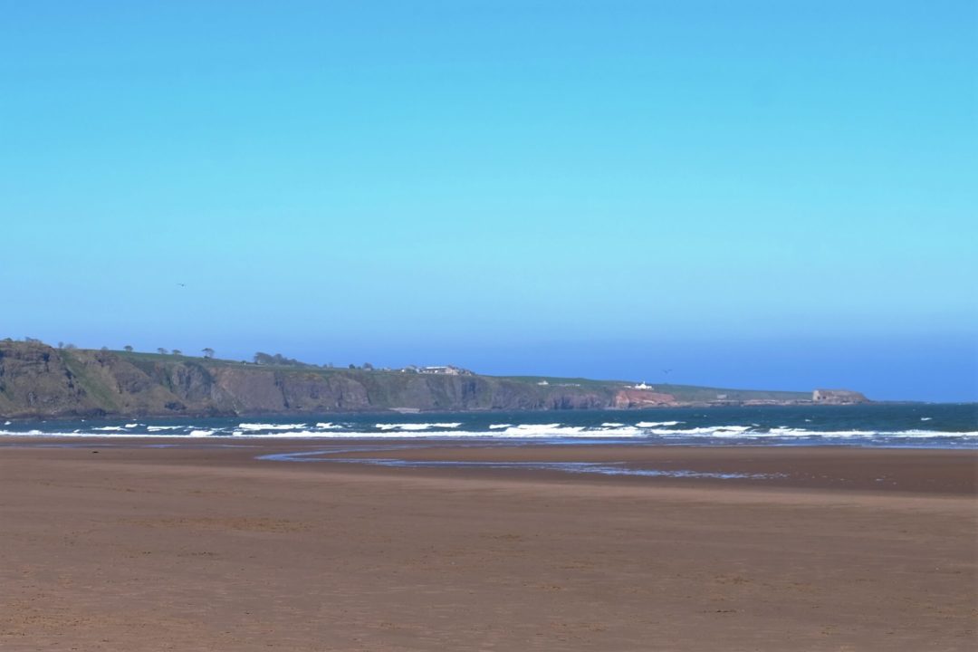
Lunan Bay, Angus
One of the finest beaches on Scotland’s east coast: a long sweep of golden sand backed by dunes, between Arbroath and Montrose. On a knoll above the beach stand the ruins of the Red Castle, a 15th-century tower house slowly crumbling into the dunes.
There’s no set route. Walk along the sand for as far as you like. The bay is popular with surfers and horse riders, but it’s big enough that you’ll rarely feel crowded.
Distance: up to 4 miles return along the beach · Difficulty: Easy · Best for: beach walking, dogs, photography · Don’t miss: the Red Castle · Where to eat: Arbroath or Montrose
Find more things to do in Angus and walk Lunan Bay.
St Cyrus, Aberdeenshire
St Cyrus National Nature Reserve is a sweep of sand, dunes and flower-rich grassland beneath old sea cliffs, just north of Montrose. In summer the grassland is alive with wildflowers and butterflies, thanks to the sheltered, south-facing cliffs.
From the visitor centre, a path leads down to the beach and along the foot of the cliffs. Look out for the old graveyard tucked into the dunes, and the salmon fishing nets on the shore.
Distance: about 3 miles · Difficulty: Easy · Best for: wildflowers, butterflies, a quiet beach · Don’t miss: the flower-rich grassland in summer · Where to eat: St Cyrus village
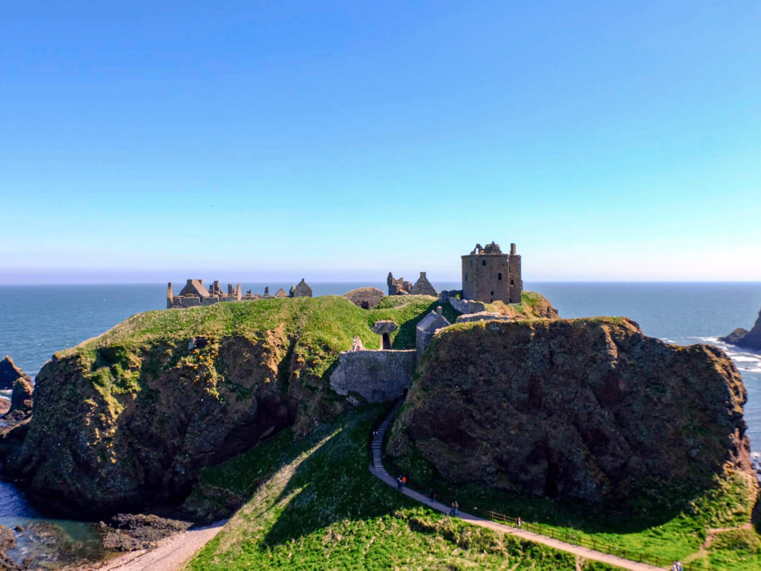
Stonehaven to Dunnottar Castle, Aberdeenshire
Few castles have a setting like Dunnottar. Its ruins cover the top of a sheer-sided rock stack, joined to the mainland by a narrow neck of land. In the 1650s, the Honours of Scotland (the Scottish crown jewels) were hidden here from Cromwell’s army.
The clifftop path from Stonehaven harbour climbs out of the town and follows the coast south to the castle, with a short detour to the Stonehaven War Memorial on the hill above. Your first view of Dunnottar from the cliffs is one of the great sights of the east coast.
Distance: about 2 miles one way, 4 miles return · Difficulty: Easy to moderate (steep steps down to the castle) · Best for: castles, photography, a stop between Edinburgh and Aberdeen · Don’t miss: the first view of the castle from the clifftop · Where to eat: fish and chips at The Bay in Stonehaven.
Walk to Dunnottar Castle from Stonehaven.
Newburgh seal beach and Forvie, Aberdeenshire
The best place on Scotland’s east coast to see seals. At the mouth of the Ythan estuary, 13 miles north of Aberdeen, a colony of more than 400 grey and common seals hauls out on the sands of Forvie, on the opposite bank from Newburgh.
From the Newburgh beach car park, a boardwalk leads through the dunes to a viewing platform and down to the beach. Watch the seals from across the river, and never try to cross or get closer. Keep dogs on a lead. Behind the seals lie the dunes of Forvie National Nature Reserve, among the largest in Britain, where a medieval village lies buried in the sand.
Distance: about 3.75 miles circular · Difficulty: Easy (soft sand) · Best for: seals, dunes, birdwatching · Don’t miss: the seals from the viewing platform · Where to eat: the Newburgh Inn
Walk the Ythan Estuary and Forvie Sands.
Cruden Bay to the Bullers of Buchan, Aberdeenshire
Start at the golden sands of Cruden Bay and follow the clifftops north to the roofless ruins of New Slains Castle, whose gothic silhouette is said to have helped inspire Bram Stoker’s Dracula.
Further north, the Bullers of Buchan is a collapsed sea cave: a huge round chasm in the cliffs, open to the sea through a natural arch, with the sea surging in at the bottom. A path runs right around its rim, which is spectacular and completely unfenced, so keep well back and keep dogs and children close.
Distance: about 5 miles return from Cruden Bay · Difficulty: Easy to moderate, with unfenced cliff edges · Best for: clifftop drama, seabirds, Dracula fans · Don’t miss: the view down into the Bullers
Drive the whole of this coast on the North East 250 and walk from Cruden Bay to the Bullers of Buchan.
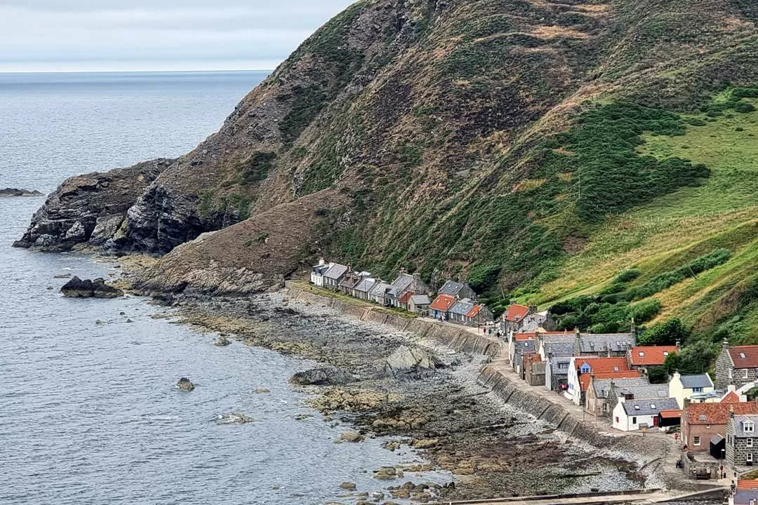
Gardenstown to Crovie, Aberdeenshire
Two of the most extraordinary villages in Scotland sit on the Moray Firth coast of Aberdeenshire, squeezed in at the foot of steep cliffs.
Crovie is a single row of fishermen’s cottages built so close to the sea that there’s no road along the front. Residents park at the top of the cliff and walk down. A shore path links it to neighbouring Gardenstown, making a short but spectacular coastal walk, with dolphins sometimes seen offshore.
A few miles west is Pennan, the village where Local Hero was filmed in 1983. Fans still come to see the red phone box on the seafront. Pair the two for a perfect half day on this coast.
Distance: about 2 miles return · Difficulty: Easy, with steep roads down to both villages · Best for: photography, fishing villages, Local Hero fans · Don’t miss: the cottage row at Crovie, the red phone box at Pennan · Where to eat: the Pennan Inn
Walk Gardenstown and Crovie.
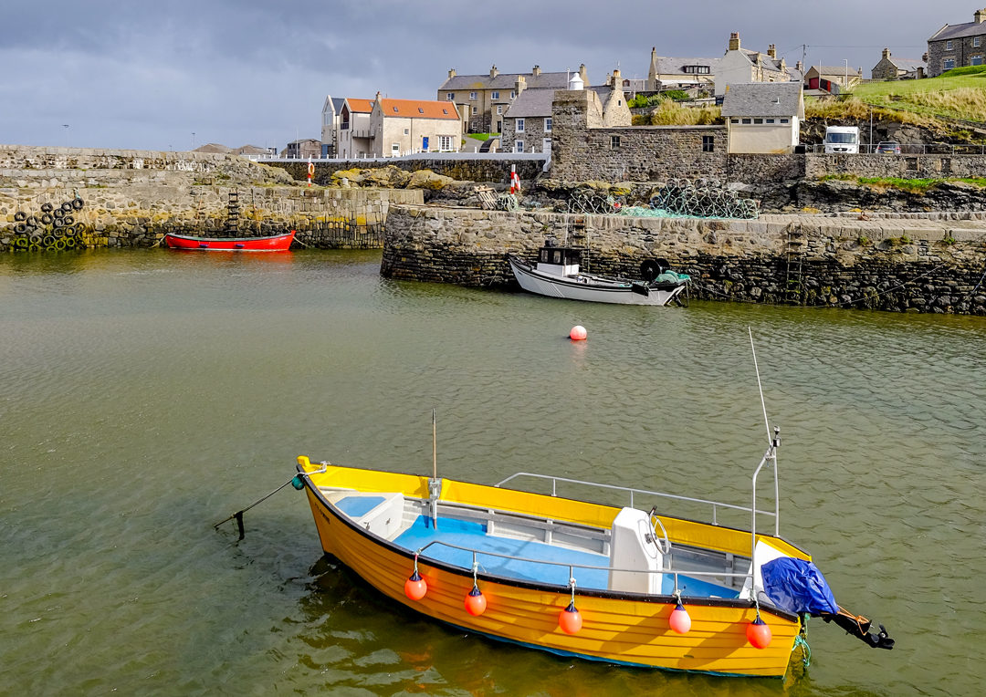
Sandend to Portsoy, Aberdeenshire
A short clifftop walk on the Moray Firth coast between two lovely villages. Sandend has a sandy bay and a cluster of old fishermen’s cottages, and the path heads east over the headland, with views along the cliffs.
Portsoy’s 17th-century harbour is one of the oldest on the Moray Firth, and a regular filming location. Look out for Portsoy marble, a green and pink serpentine stone that was once used in the Palace of Versailles.
Distance: about 2.5 miles one way · Difficulty: Easy to moderate · Best for: harbours, photography · Don’t miss: Portsoy’s old harbour · Where to eat: Ice cream in Portsoy
Walk the Portsoy and Sandend circular.
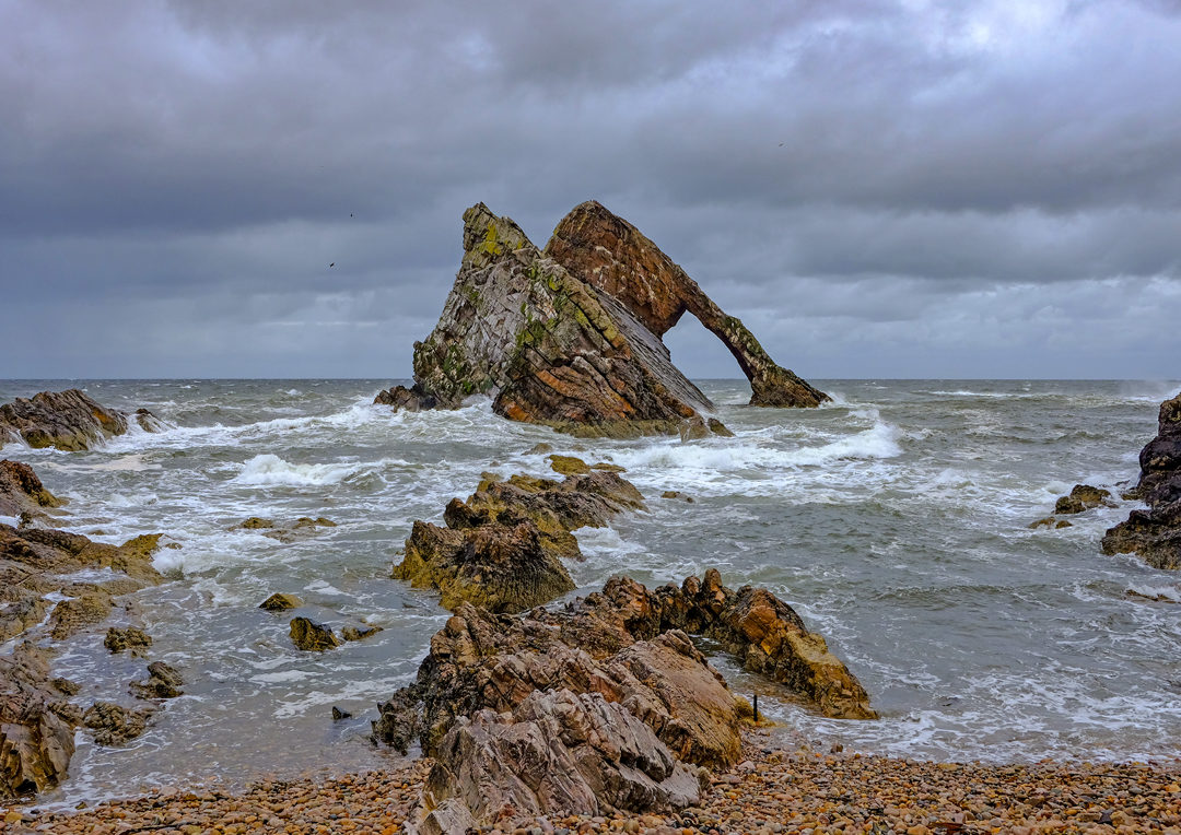
Bow Fiddle Rock, Portknockie, Moray
One of the most photographed rocks in Scotland: a great quartzite sea arch just off Portknockie, shaped like the tip of a fiddler’s bow. A short path drops from the village to the shore beside it. Come at sunset, or on a calm day when the arch is reflected in the water.
For a longer walk, follow the Moray Coast Trail east along the clifftops to Cullen, with its railway viaduct, big sandy bay and the soup that made it famous.
Distance: 1 mile return, or about 4 miles return to Cullen · Difficulty: Easy · Best for: photography, sunsets, an easy stop on the Moray coast · Don’t miss: Bow Fiddle Rock at sunset · Where to eat: Cullen skink in Cullen, of course
Read more: things to do on the Moray Firth and walk past Bow Fiddle Rock on the Moray Coast Trail from Buckie to Cullen.
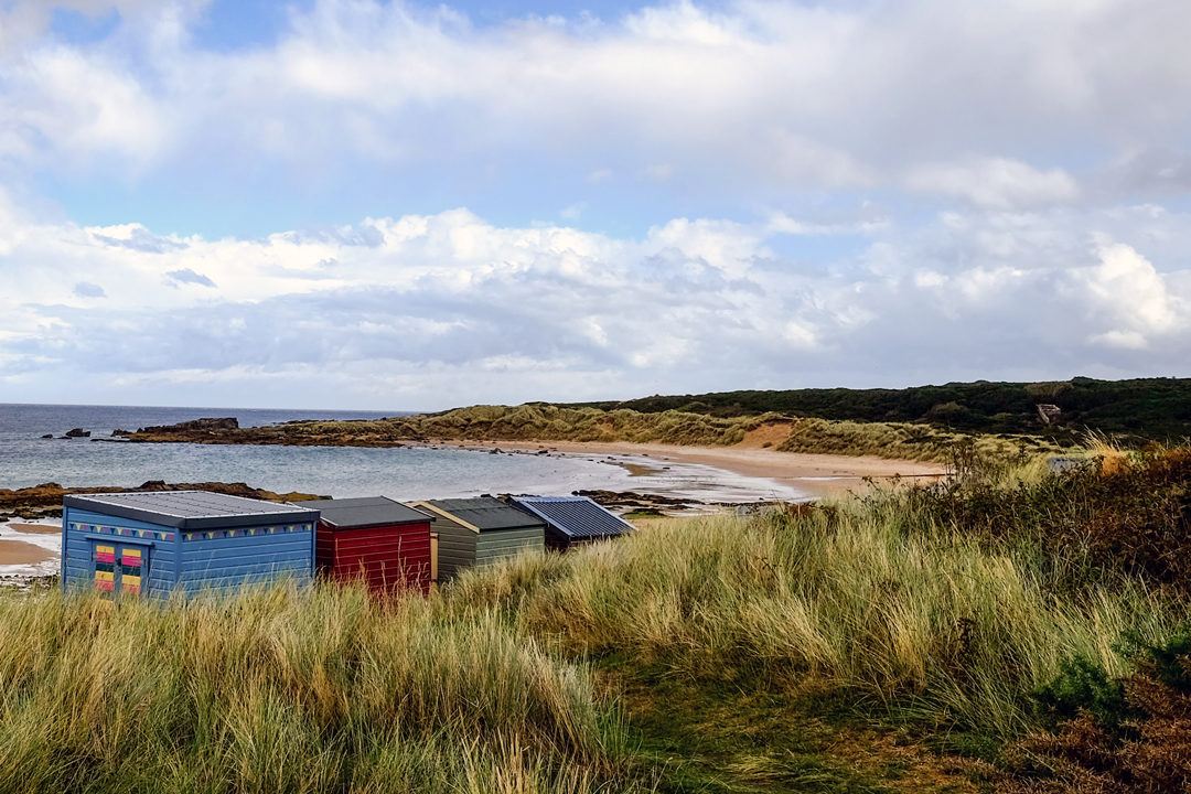
Findhorn to Hopeman on the Moray Coast Trail
The Moray Coast Trail stretches 50 miles from Forres to Cullen along the Moray Firth. My favourite section starts at Findhorn and follows the coast to Hopeman.
Findhorn is best known for its eco-community, the Findhorn Foundation, and the nearby Kinloss Barracks. It also has a spectacular, if windswept, beach. The village sits at the mouth of the River Findhorn, which has formed a beautiful bay ringed by mudflats and sand dunes. We spotted a colony of grey seals basking on the sand.
From Findhorn, follow the coast round Burghead Bay to the village of Burghead (stop for lunch at the Bothy), then walk on to Hopeman and its row of painted beach huts.
Distance: 12 miles one way, easy to break into shorter sections · Difficulty: Easy · Best for: seals, beach huts, big skies · Don’t miss: the painted beach huts at Hopeman · Where to eat: the Bothy, Burghead
Read more: Findhorn to Burghead walk.
South west Scotland and Argyll
The Mull of Galloway, Dumfries and Galloway
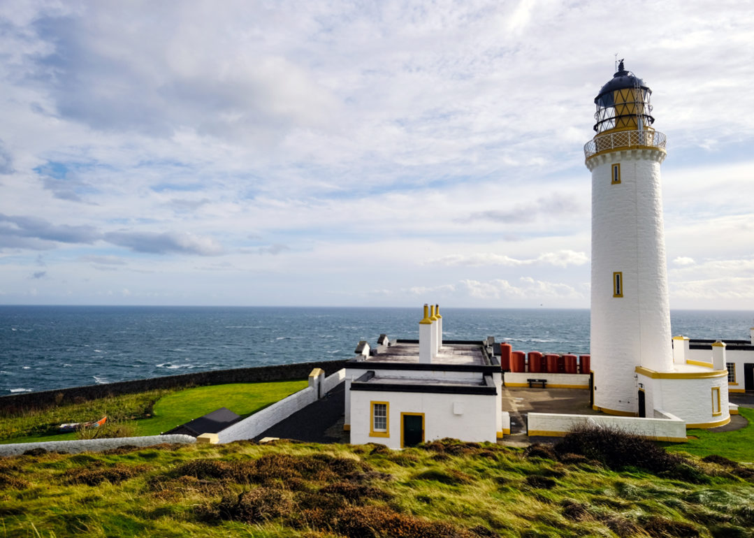
Scotland’s most southerly point, where a lighthouse stands on the end of a wild peninsula with the Irish Sea on three sides. On a clear day you can see Northern Ireland, the Isle of Man and the Lake District hills.
Short paths around the RSPB nature reserve follow the clifftops, where guillemots, razorbills and puffins nest in early summer. Climb the lighthouse when it’s open, and look out for the foghorn perched below it.
Distance: 1 to 2 miles of short clifftop paths · Difficulty: Easy · Best for: the end-of-Scotland feeling, seabirds · Don’t miss: the view from the lighthouse · Where to eat: the Gallie Craig coffee house, built into the clifftop.
Drive this coast on the South West Coastal 300 and walk the Mull of Galloway.
St Ninian’s Cave, Whithorn
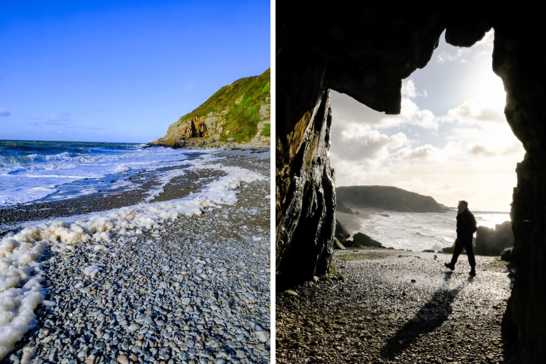
Whithorn is known as the cradle of Christianity in Scotland, where St Ninian is said to have founded a church around 400 AD. A short walk from the Physgill car park follows a wooded glen down to a shingle beach and the cave where Ninian is said to have gone to pray.
Early Christian crosses were carved into the rock here, and pilgrims still visit, leaving little crosses made from driftwood and pebbles. Wicker Man fans will recognise the beach too.
Distance: about 2.5 miles return · Difficulty: Easy (pebble beach) · Best for: history, a quiet beach · Don’t miss: the crosses left by pilgrims · Where to eat: Whithorn or the Isle of Whithorn
Walk to St Ninian’s Cave from Kidsdale.
Portpatrick to Dunskey Castle, Dumfries and Galloway
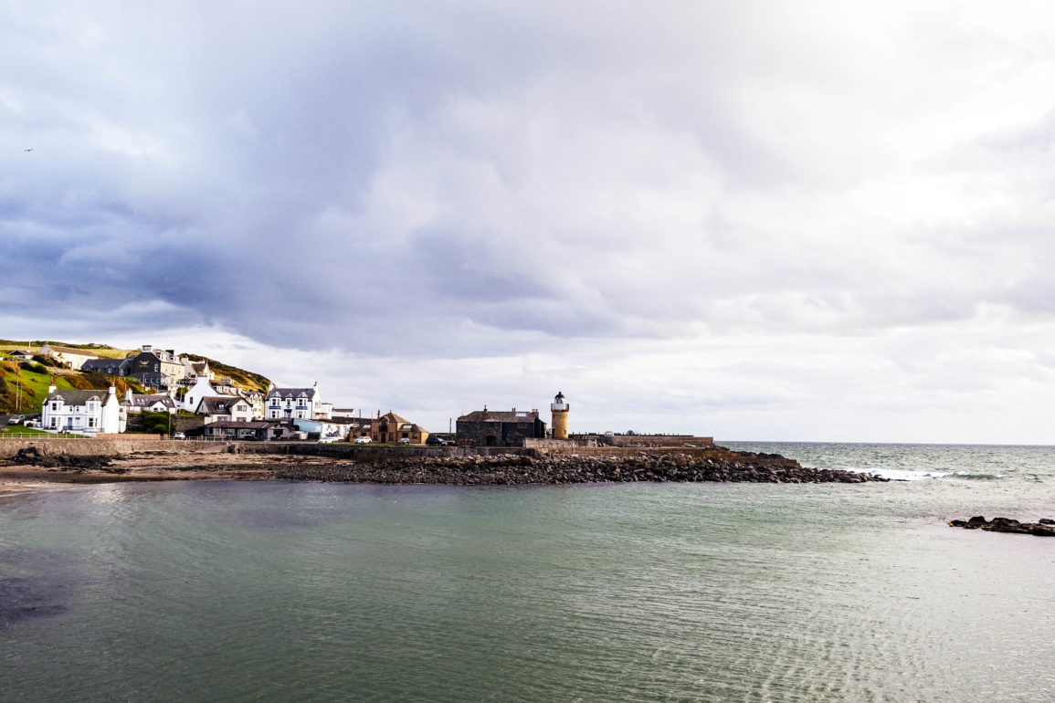
Portpatrick is a pretty harbour village of painted houses facing the Irish Sea, and the western end of the Southern Upland Way. Follow the path south out of the village along the clifftops to the ruins of Dunskey Castle, a 16th-century tower house perched on a headland above the sea.
It’s a short walk, so you’ll have time for an ice cream on the harbour afterwards. Walkers setting off on the 214-mile Southern Upland Way start here, heading the other way.
Distance: about 2 miles return · Difficulty: Easy to moderate · Best for: a short clifftop walk, castle ruins · Don’t miss: the view back over Portpatrick harbour · Where to eat: the pubs and cafés on Portpatrick harbour
Walk to Dunskey Castle from Portpatrick.
Rockcliffe to Kippford, Dumfries and Galloway
An easy, much-loved walk on the Solway coast between two pretty villages. The Jubilee Path runs through woodland and along the shore from Rockcliffe to Kippford, passing the Mote of Mark, the site of an ancient hillfort with views over the estuary.
At low tide you can walk out across the sand to Rough Island, a small bird reserve, but check the tide first and stay off the island during the bird nesting season in May and June.
Distance: about 3.5 miles return on the Jubilee Path · Difficulty: Easy · Best for: families, estuary views, a pub at the end · Don’t miss: the Mote of Mark viewpoint · Where to eat: the pubs on the waterfront in Kippford
Walk from Rockcliffe to Kippford.
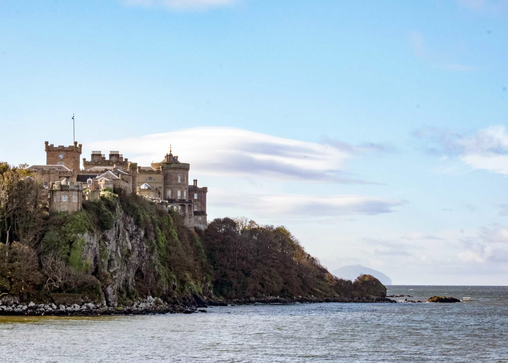
Dunure to Culzean Castle on the Ayrshire Coastal Path
The Ayrshire village of Dunure has a ruined clifftop castle, a tiny harbour and a small labyrinth, and sits on the Ayrshire Coastal Path. It’s about an hour’s drive from Glasgow.
From Dunure, follow the coastal path south to Culzean Castle. This huge National Trust for Scotland castle sits high on a clifftop on the edge of the Ayrshire coast. Designed by the architect Robert Adam, it’s surrounded by a 260-hectare country park with its own beaches.
Did you know Culzean Castle is pronounced “Cul-ane”, and was used as Lord Summerisle’s castle in The Wicker Man?
After your walk, have lunch at the Harbourside Cafe or dinner and drinks at the Anchorage Inn.
Distance: 5 miles one way · Difficulty: Moderate · Best for: castles, Wicker Man fans, a day out from Glasgow · Don’t miss: the labyrinth at Dunure, Culzean Castle · Where to eat: the Harbourside Cafe, Dunure
More things to do in Ayrshire and walk from Maidens to Culzean and Dunure.
Portencross Castle, North Ayrshire
A short and easy coastal walk about an hour from Glasgow. From Seamill, near West Kilbride, the path follows the shore round to Portencross, where a 14th-century castle stands right at the water’s edge, looking across the Firth of Clyde to Arran and Little Cumbrae.
The castle was saved and restored by the local community, and is open to visitors in summer. Beyond it, a path continues along the foot of the cliffs, with seals often hauled out on the rocks.
Distance: about 3 miles return from Seamill · Difficulty: Easy · Best for: an easy day from Glasgow, views of Arran · Don’t miss: Portencross Castle · Where to eat: take a picnic, or head to West Kilbride
Walk to Portencross on the Ardrossan to Portencross stage.
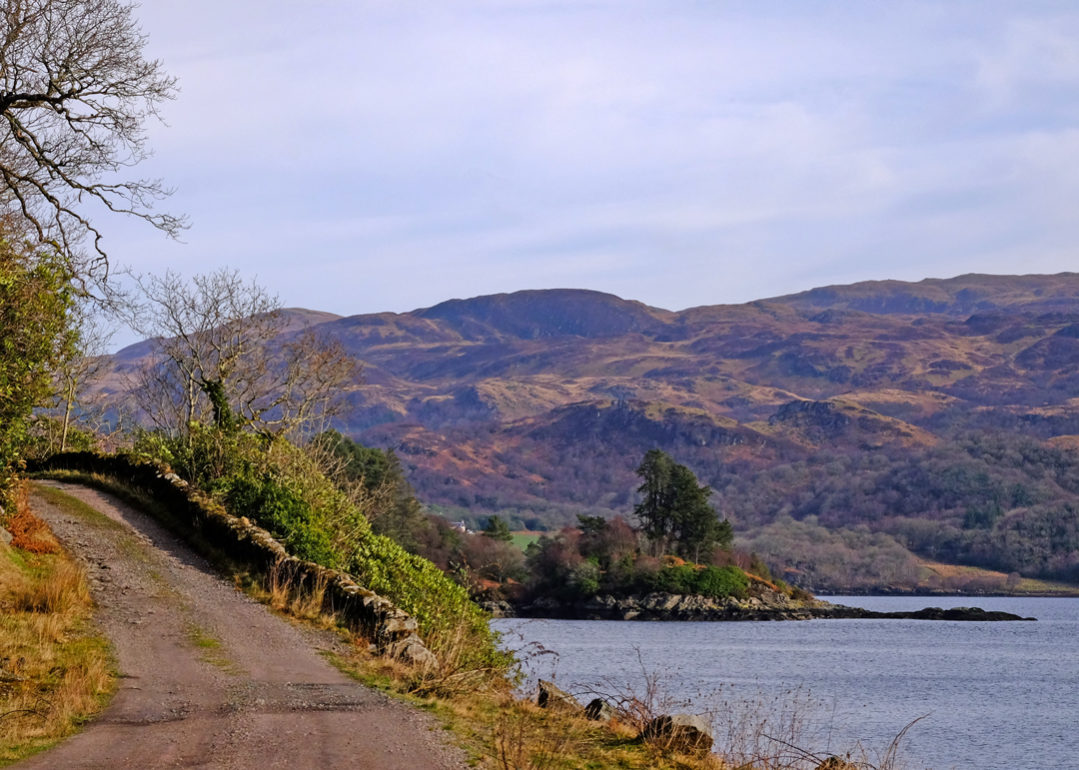
The Kyles of Bute from Tighnabruaich, Cowal
Say hello to Scotland’s “secret coast”, the Cowal Peninsula. Lying between Loch Fyne and the Firth of Clyde, and partly within the Loch Lomond and the Trossachs National Park, Cowal stretches from Dunoon out to the beaches of Ostel Bay.
From the village of Tighnabruaich, a coastal path follows the Kyles of Bute, the narrow sea channels between Cowal and the Isle of Bute. It leads to Caladh Lighthouse and Eilean Dubh (the black island) at the mouth of Loch Riddon.
The walk takes about 2 hours, but you can walk as far as you like. You’re following the Loch Lomond and Cowal Way, which runs from Portavadie on Cowal to Inveruglas on Loch Lomond.
Distance: 4 miles return (extendable) · Difficulty: Easy to moderate · Best for: a quiet coastline, lighthouse views · Don’t miss: Caladh Lighthouse, Eilean Dubh · Where to eat: the Oystercatcher at Otter Ferry or Inver Restaurant (book both in advance)
Read more: how to visit the Cowal Peninsula and walk the Kyles of Bute from Tighnabruaich.
Carradale Point, Kintyre
On Kintyre’s quiet east coast, Carradale looks across the Kilbrannan Sound to the mountains of Arran. A short circuit from Port Righ beach runs out around Carradale Point, a rocky headland topped by the remains of an Iron Age vitrified fort, where a herd of feral goats roams the rocks.
For a longer day, the Kintyre Way continues south from Carradale along the coast towards Campbeltown, and the Carradale Forest trails offer bigger views from the hills behind the village.
Distance: about 2.5 miles circular · Difficulty: Easy · Best for: quiet beaches, views to Arran, wildlife · Don’t miss: the vitrified fort on the point · Where to eat: Carradale village
Walk Carradale Bay and Point.
Davaar Island, Campbeltown, Kintyre
One of Scotland’s most unusual walks. At the mouth of Campbeltown Loch, Davaar Island is joined to the mainland at low tide by the Doirlinn, a long shingle causeway that disappears as the tide comes in.
Once across, follow the rocky shore around the south side of the island to a series of sea caves. In the seventh is a life-sized painting of the Crucifixion, painted secretly by local artist Archibald MacKinnon in 1887. Climb to the top of the island on the way back for views over Campbeltown and across to Arran.
The causeway is only uncovered for a few hours around low tide, and the tide comes in quickly. Check tide times before you go (Campbeltown’s tourist information has them), and give yourself plenty of time to get back.
Distance: about 4 miles return, including the causeway · Difficulty: Easy to moderate (rocky shore to the caves), and tidal · Best for: history, a real adventure · Don’t miss: the Crucifixion cave painting · Where to eat: Campbeltown
The Mull of Kintyre lighthouse
Made famous by Paul McCartney’s 1977 song, the Mull of Kintyre is the wild south-western tip of the peninsula. From the car park at the end of a long single-track road, a steep tarmac lane drops down the hillside to the lighthouse, perched above the sea with Northern Ireland only 12 miles away across the water.
Going down is easy. The climb back up is steep and long, so take your time. On a clear day, you can see the Antrim coast and Rathlin Island.
Distance: about 2.5 miles return · Difficulty: Moderate (a steep climb back up) · Best for: big views, the end-of-the-road feeling · Don’t miss: the view to Northern Ireland · Where to eat: take a picnic, or head to Southend or Campbeltown
Walk to the Mull of Kintyre lighthouse.
Machrihanish Bay, Kintyre
On Kintyre’s Atlantic coast, Machrihanish Bay is a three-mile sweep of sand backed by dunes and one of Scotland’s most famous links golf courses, looking out to Islay and Jura. It’s one of the best surfing beaches on the west coast.
Walk north along the sand from Machrihanish village towards Westport for as far as you like. The Kintyre Way finishes here, at the end of its 100-mile route from Tarbert.
Distance: up to 6 miles return along the beach · Difficulty: Easy · Best for: beach walking, sunsets, surfing · Don’t miss: the views to Islay and Jura · Where to eat: Machrihanish village
The Isle of Kerrera, Oban
Kerrera sits just across the water from Oban, but it feels a world away. A small passenger ferry crosses from Gallanach, a couple of miles south of the town, and there are no cars on the island beyond a few farm vehicles.
A track and path loop around the southern half of the island, passing the ruins of Gylen Castle on a sea cliff at the southern tip, with views to Mull, Lismore and the mountains of Morvern. The Kerrera Tea Garden, near the castle, makes a perfect halfway stop in season.
Distance: about 6.5 miles circular · Difficulty: Moderate · Best for: an island adventure from Oban · Don’t miss: Gylen Castle · Where to eat: the Kerrera Tea Garden (seasonal)
Walk the Gylen Castle circuit on Kerrera.
The Highlands and the NC500
Sanna Bay from Portuairk, Ardnamurchan (Lochaber)
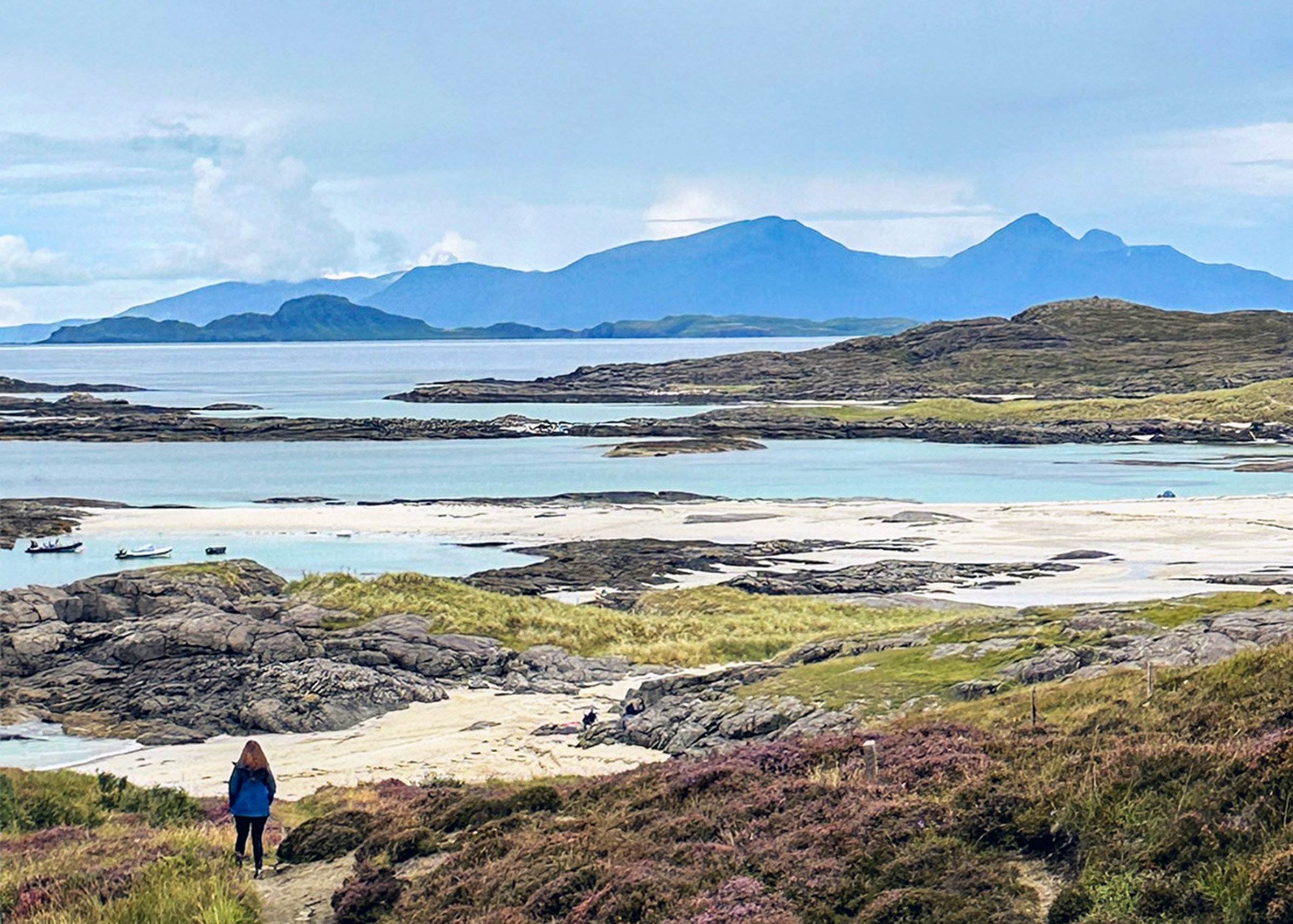
Looking for Scotland’s best beach? Let me introduce you to Sanna Bay on the Ardnamurchan Peninsula, one of Scotland’s hidden gems and one of the best views in the country.
At the very end of the peninsula, Sanna Bay is a sweep of white sand and turquoise sea with views to the Small Isles of Rùm, Eigg and Muck. You can drive to Sanna, but my favourite way to arrive is on foot along the coastal path from the hamlet of Portuairk.
Portuairk claims to be the most westerly settlement on the British mainland, its crofting cottages hugging the coast in the most spectacular spots. Walking from here means you arrive high above Sanna, looking down on sea so blue it needs no editing. The path then drops down to the white sand.
Distance: 4 miles return · Difficulty: Moderate · Best for: white sand, views to the Small Isles · Don’t miss: the first view of Sanna from above the bay · Where to eat: the Kilchoan Hotel on the way back
Walk to Sanna from Portuairk.
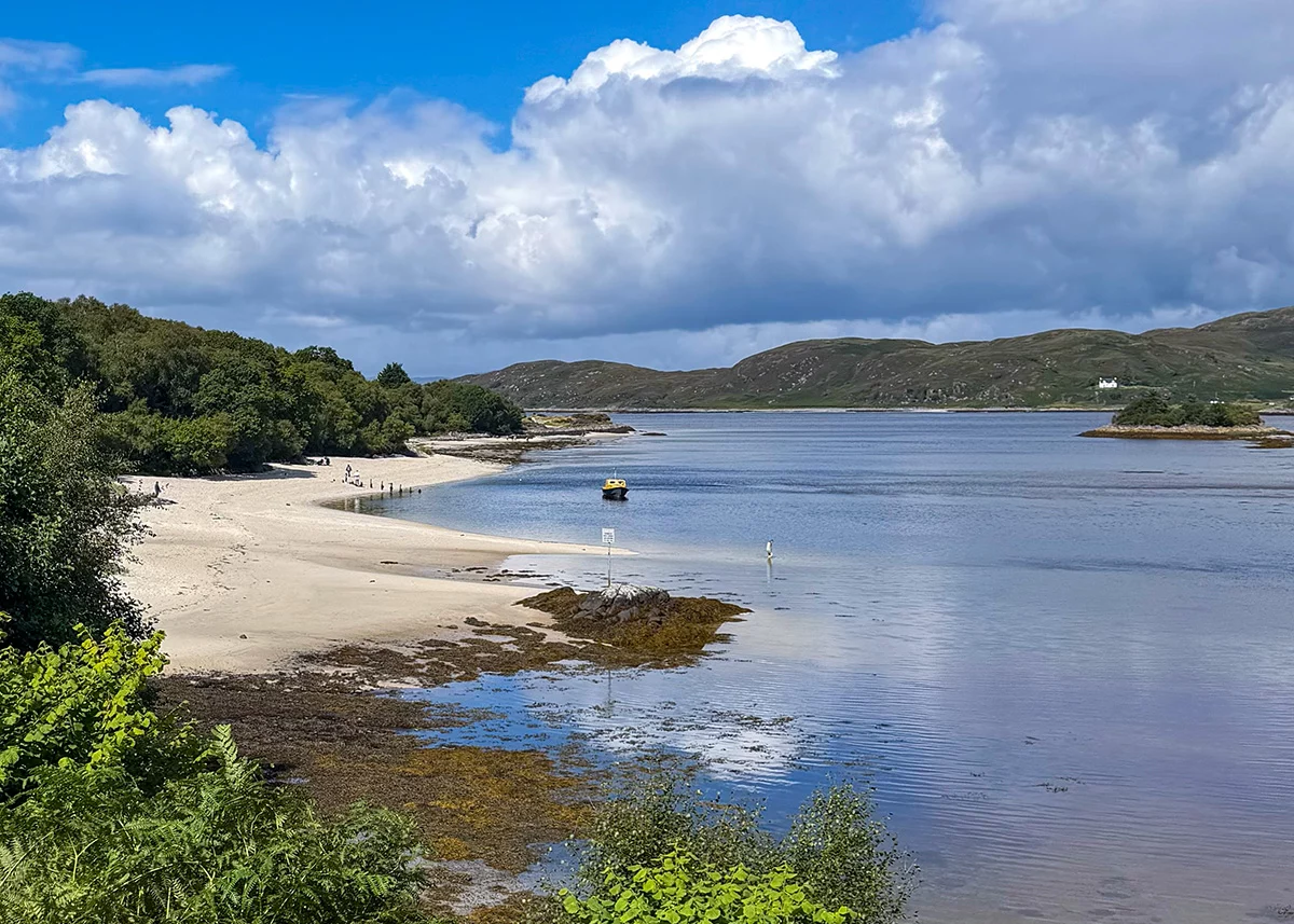
The Silver Sands of Morar, Lochaber
Between Arisaig and Morar, the Road to the Isles passes a string of white-sand beaches and turquoise bays, looking out to the islands of Eigg and Rùm. The beach at Camusdarach was one of the locations for Local Hero.
There’s no set route. Park at one of the beaches and walk along the sand and over the rocky headlands between them for as long as you like. Come in the evening for one of the best sunsets on the west coast.
Distance: 2 to 4 miles, as far as you like · Difficulty: Easy · Best for: white sand, sunsets, families · Don’t miss: the views of Eigg and Rùm at sunset · Where to eat: Arisaig, a few miles south
Read more: the Road to the Isles road trip and the best beaches at Arisaig
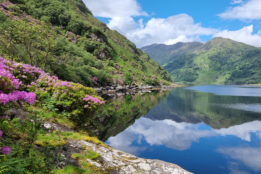
Kinloch Hourn to Barrisdale Bay, Knoydart (Lochaber)
In a country the size of Scotland, it’s surprising there are still places so remote it takes days to reach them. Knoydart, often called Britain’s last wilderness, has no road in. You arrive by boat from Mallaig, or on foot on a 15-mile walk from Kinloch Hourn.
From Kinloch Hourn, an old path follows the shore of Loch Hourn, one of Scotland’s most dramatic, fjord-like sea lochs, to Barrisdale Bay and on to Inverie, the main village on the peninsula. You can make it as long or as short as you like.
The full route to Inverie takes around 8 hours. Most people stop at Barrisdale, 6.75 miles (about 4 hours) in, where there’s a campsite and bothy, before either continuing or heading back. Look out for otters, red deer and even dolphins. From Inverie, a passenger ferry takes you back to Mallaig. The route forms part of the Cape Wrath Trail.
Distance: 13.5 miles return to Barrisdale, 15 miles one way to Inverie · Difficulty: Hard, remote · Best for: wilderness, otters and red deer · Don’t miss: the view down Loch Hourn, the Old Forge at Inverie · Where to eat: the Old Forge in Inverie, Britain’s most remote mainland pub, if you make it that far
Read more: how to visit Kinloch Hourn.
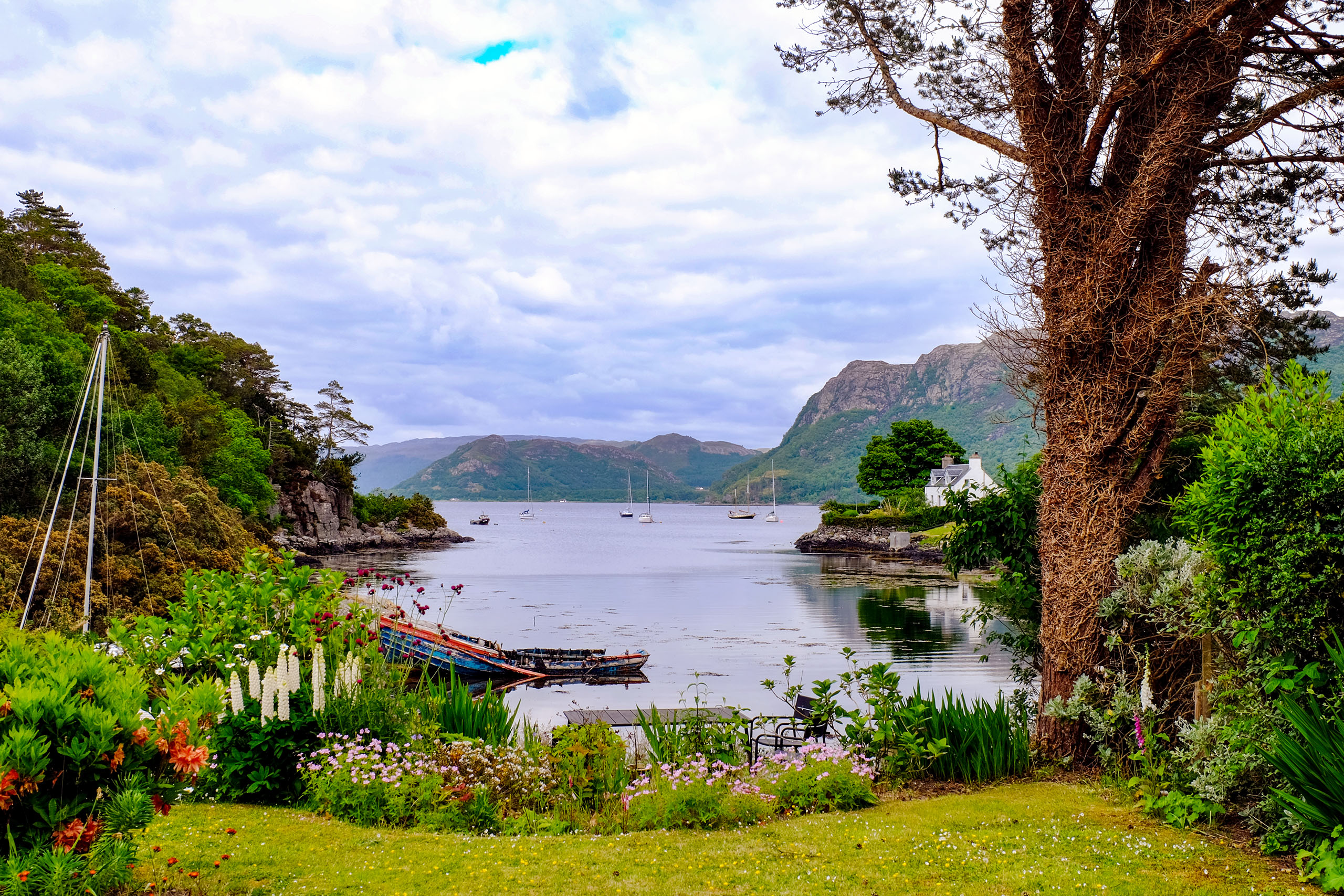
Plockton shore walk, Wester Ross
Plockton is one of the prettiest villages in Scotland: white-painted cottages, palm trees (yes, really, thanks to the Gulf Stream) and small boats bobbing in a sheltered bay. It sits on the south shore of Loch Carron, looking north towards the hills of Applecross.
The shore path runs out from the village towards Duncraig Castle, with views across the loch and out towards Skye. Otters are regularly seen in the bay, and Calum’s Seal Trips is one of the best small wildlife boats in Scotland.
Distance: about 3 miles return · Difficulty: Easy · Best for: otters, palm trees, a postcard village · Don’t miss: the view back over the village, Duncraig Castle · Where to eat: the Plockton Inn or the Plockton Hotel
Walk to Duncraig from Plockton.
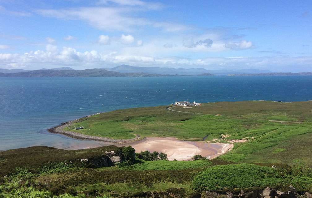
Applecross to Sand, Wester Ross
Applecross really does feel like the end of the world. To get here, you either brave the famous Bealach na Bà pass or the long, winding coast road from Shieldaig. Both take nerves of steel if you’re not used to Scotland’s west coast roads. Make it, and the peninsula is as blissful as it gets.
The North Coast 500 passes the Applecross Inn, but don’t just get back in your car. Follow the coastal path 4.25 miles (7 km) north from Applecross to the beach at Sand for a picnic, with views across the Inner Sound to Raasay and Skye.
Pick up your picnic from the Potting Shed, the café in Applecross’s beautiful walled garden. Book in for dinner at the Applecross Inn on your return.
Distance: 4.25 miles one way, 8.5 miles return · Difficulty: Moderate · Best for: views to Skye and Raasay, an NC500 stopover · Don’t miss: the walled garden, the beach at Sand · Where to eat: the Potting Shed, the Applecross Inn
Walk from Applecross to Sand.
Red Point, near Gairloch
At the end of a single-track road south-west of Gairloch, Red Point has two beaches of red sandstone sand looking out to Skye, Rona and, on a clear day, the Outer Hebrides. It’s one of the best sunset spots on the west coast.
From the car park, a path leads over the dunes to the southern beach and an old salmon fishing station. Experienced walkers can continue along the rough coastal path towards Diabaig, one of the remotest stretches of coast in Wester Ross.
Distance: about 2 miles return to the beaches · Difficulty: Easy · Best for: sunsets, beaches, island views · Don’t miss: the sunset over Skye · Where to eat: Gairloch
Walk the Red Point beaches.
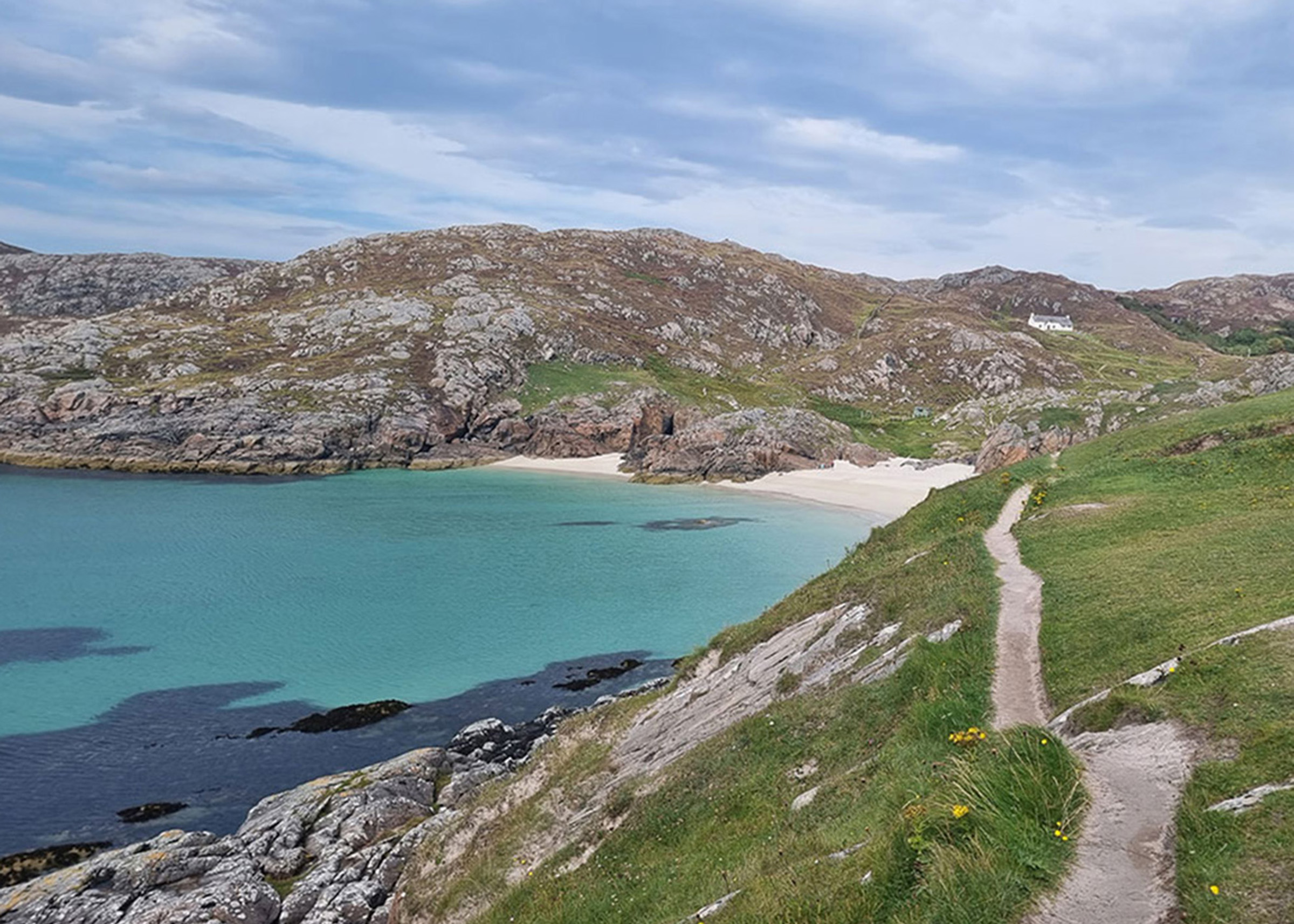
Achmelvich and the Hermit’s Castle, Assynt
Achmelvich is one of the most beautiful beaches in the north-west, a sweep of white sand and turquoise water a few miles from Lochinver, with the mountains of Assynt behind.
A short walk over the rocks and headland to the north leads to the Hermit’s Castle, a tiny concrete bothy built into the rocks in the 1950s and often called the smallest castle in Europe. It’s hard to spot until you’re almost on top of it.
Distance: 1 mile return · Difficulty: Easy · Best for: white sand, families, a curiosity · Don’t miss: the Hermit’s Castle · Where to eat: a pie from the Lochinver Larder.
Walk Achmelvich beach.
The Old Man of Stoer, Assynt
From Stoer Head lighthouse, a clifftop path heads north over the moorland to a viewpoint above the Old Man of Stoer, a slender sea stack rising from the waves at the foot of the cliffs. It’s the far north-west’s answer to the Old Man of Hoy.
The path is boggy in places, and you can return the same way or climb over the Sidhean Mòr hill for big views to the Assynt mountains. It’s about 40 minutes’ drive from Kylesku, and pairs well with a day around Lochinver and Achmelvich.
Distance: about 5 miles return from Stoer Head lighthouse · Difficulty: Moderate (boggy in places) · Best for: sea stacks, big skies · Don’t miss: the first view of the Old Man · Where to eat: Lochinver on the way back
Walk to the Old Man of Stoer.
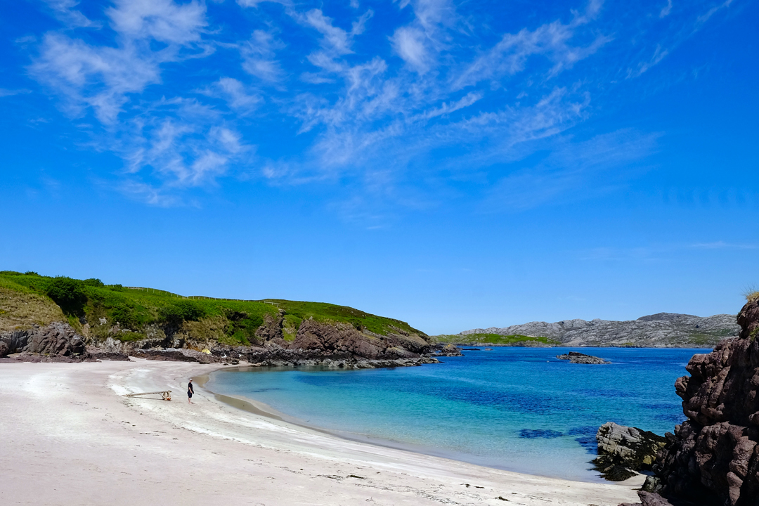
Handa Island, Sutherland
Just off the far north-west coast lies Handa, one of Scotland’s most beautiful small islands and a nationally important wildlife reserve run by the Scottish Wildlife Trust.
It’s home to puffins, great skuas (bonxies), superb views of the Assynt mountains and one of the loveliest beaches in the north-west. The 4-mile circular path, partly on boardwalk, takes around 2 hours. Allow longer if you stop every few seconds to scan the cliffs for puffins.
The Handa Island ferry leaves from the tiny settlement of Tarbet, 10 minutes north of Scourie down a single-track road. It’s a small passenger boat, and it only runs in the spring and summer season. Tarbet is about 45 minutes north of Lochinver and 50 minutes south of Durness.
Distance: 4 miles circular · Difficulty: Easy · Best for: puffins, great skuas, views of Assynt · Don’t miss: the Great Stack of Handa · Where to eat: the Shorehouse Restaurant at Tarbet, by the ferry.
Read more: how to visit Handa Island.
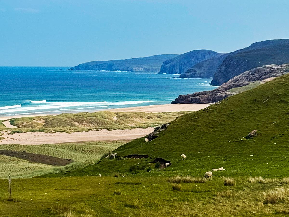
Sandwood Bay, Sutherland
The most spectacular beach in mainland Britain, and you can only reach it on foot. Sandwood Bay sits on the far north-west coast, a few miles south of Cape Wrath. The way in is a 4-mile walk across moorland from the road end at Blairmore, near Kinlochbervie.
The reward is a mile of pink sand backed by towering dunes, the Am Buachaille sea stack at the southern end, and often not another soul in sight. Allow 4 hours for the round trip, plus time on the beach. Take everything you need with you: there’s nothing at the bay.
Distance: 8 miles return · Difficulty: Moderate · Best for: the wildest beach in Scotland · Don’t miss: the Am Buachaille sea stack · Where to eat: Kinlochbervie has a small shop; otherwise try the Old School Restaurant at Inshegra.
Walk to Sandwood Bay.
Cape Wrath, Sutherland
The most remote walk in Britain. Cape Wrath is the north-west tip of mainland Scotland, with no road in from the outside world. You reach it by a small passenger ferry across the Kyle of Durness from Keoldale, then a minibus along an 11-mile track to the lighthouse, or on foot or by bike.
The ferry and minibus run from May to September, weather permitting. Cape Wrath is also an active military range, and the area is closed to the public during live firing, so check before you go.
For ambitious walkers, the Cape Wrath Trail is a 230-mile route from Fort William to Cape Wrath, often called the toughest long-distance walk in Britain. For everyone else, the day trip from Durness is unforgettable: ferry, minibus, lighthouse, lunch at the Ozone Café, and back.
Distance: day trip by ferry and minibus, or 22 miles return on foot from the ferry · Difficulty: Day trip easy, full trail very hard · Best for: the edge-of-the-world feeling · Don’t miss: the Ozone Café, surely Britain’s most remote · Where to eat: Cocoa Mountain in Durness for hot chocolate.
Plan your trip with Visit Cape Wrath.
Balnakeil Bay to Faraid Head, Durness
Just outside Durness, Balnakeil Bay is a long curve of pale sand backed by huge dunes, with a ruined 17th-century church and graveyard at its southern end. Walk north along the beach and through the dunes towards Faraid Head, where puffins nest on the cliffs in early summer.
The tip of the headland is a Ministry of Defence site, so follow the signs and keep out of the fenced area. Combine the walk with a visit to Smoo Cave, just east of the village.
Distance: about 4 miles (6.5 km) return · Difficulty: Easy to moderate (soft sand in the dunes) · Best for: beaches, puffins, an NC500 stop · Don’t miss: Balnakeil church and graveyard · Where to eat: hot chocolate at Cocoa Mountain in Balnakeil craft village.
Walk to Faraid Head from Balnakeil.
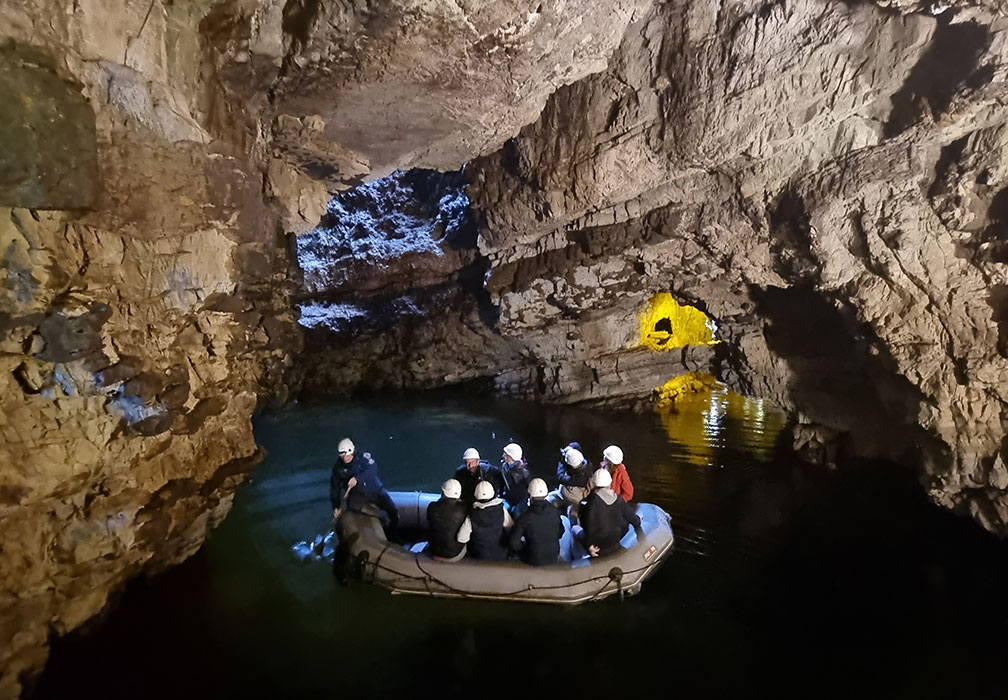
Smoo Cave, Durness
Just east of Durness, a set of steps leads down into a narrow inlet to the entrance of Smoo Cave, one of the largest sea caves in Britain. Inside, a waterfall crashes through a hole in the roof into an inner chamber, and in summer you can take a short boat tour further into the cave.
For a longer walk, follow the clifftops east from the cave, or head west to the beach at Sango Bay. There are several loops from the car park, from a short stroll to around five miles.
Distance: 1 to 5 miles, depending on the loop · Difficulty: Easy (steps down to the cave) · Best for: families, a rainy-day NC500 stop · Don’t miss: the waterfall inside the cave · Where to eat: the Smoo Cave Hotel
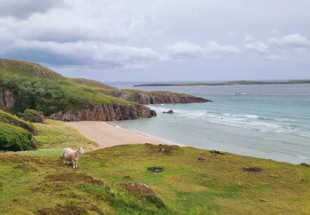
Ceannabeinne Township Trail, near Durness
A short walk with a big story. A few miles east of Durness, a waymarked trail loops around the ruins of Ceannabeinne, a township whose people famously resisted being cleared from their homes in 1841. Information boards along the way tell the story, and the coastal views are superb.
Right beside the trail is Traigh Allt Chailgeag, a small white-sand beach tucked between rocky cliffs, often called one of the most beautiful beaches on the north coast.
Distance: half a mile (1 km) · Difficulty: Easy (some rough ground) · Best for: history, a quiet beach · Don’t miss: the beach below the ruins · Where to eat: Durness, 10 minutes away
Walk the Ceannabeinne Township Trail.
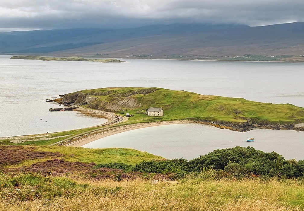
Ard Neakie, Loch Eriboll
Halfway along the east shore of Loch Eriboll, a tiny tidal island is joined to the shore by a curving spit of shingle and sand. Walk out along it to the ruins of 19th-century lime kilns, built from the local limestone, with views up and down one of Scotland’s deepest sea lochs.
Loch Eriboll has a remarkable history. At the end of the Second World War, dozens of German U-boats sailed into the loch to surrender. Look out for otters, seals and the names of ships picked out in stones on the hillside above the road.
Distance: about 2 miles return · Difficulty: Easy · Best for: history, photography, an NC500 stop · Don’t miss: the lime kilns · Where to eat: take a picnic
Walk to the Ard Neakie lime kilns.
Talmine and Achininver beaches, near Tongue
On the west side of the Kyle of Tongue, the little crofting village of Talmine looks out to the Rabbit Islands. A circular walk links Talmine’s sheltered sandy beach with the hidden bay of Achininver, crossing open moorland with big views to Ben Loyal and Ben Hope.
Achininver is one of those beaches you’re likely to have to yourself, even in summer. The moorland section is rough and boggy in places, so wear boots.
Distance: about 6 miles (10 km) circular · Difficulty: Moderate (rough and boggy moorland) · Best for: empty beaches, mountain views · Don’t miss: Achininver Bay · Where to eat: Tongue
Walk the Talmine and Achininver circuit.
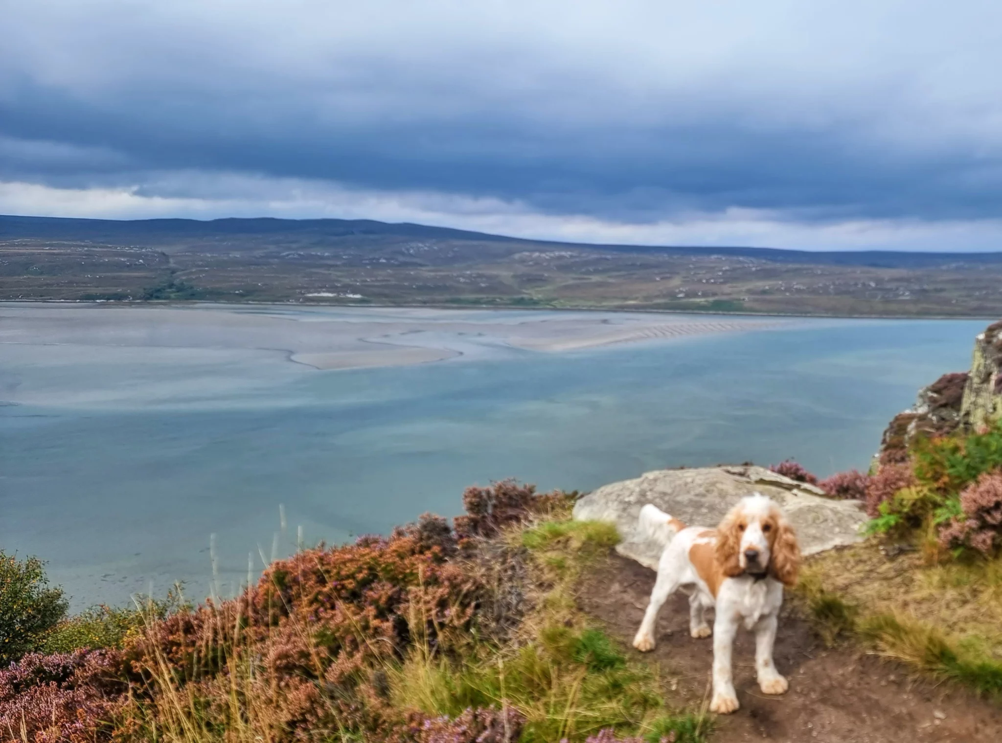
Castle Varrich, Tongue
A short, easy walk from the village of Tongue to the ruins of Caisteal Bharraich, a medieval tower on a knoll above the Kyle of Tongue. It’s more of a viewpoint than a castle now, but what a viewpoint: the kyle, the sands and the Rabbit Islands in one direction, and Ben Loyal in the other.
The path climbs gently through woodland and over moorland. Come in the evening for the best light over the kyle.
Distance: about 2 miles return · Difficulty: Easy · Best for: views, a short evening walk · Don’t miss: the view over the Kyle of Tongue · Where to eat: Tongue
Walk to Castle Varrich (Caisteal Bharraich).
Strathy Point, north coast
Between Tongue and Melvich, a narrow headland juts out into the Pentland Firth with a lighthouse at its tip. From the car park, a single-track road (closed to cars) leads out along the headland to the lighthouse, with sea cliffs, arches and stacks on either side.
It’s one of the best places on the north coast to watch for whales, dolphins and seabirds, with big views west to Cape Wrath and east towards Orkney.
Distance: about 2 miles return · Difficulty: Easy · Best for: whale watching, seabirds, an NC500 stop · Don’t miss: the arches below the lighthouse · Where to eat: take a picnic, or head to Bettyhill
Walk to Strathy Point.
Holborn Head, Scrabster
Just beyond the ferry port at Scrabster, near Thurso, a clifftop path leads out past the Holborn Head lighthouse to a headland riddled with deep geos, blowholes and stacks. At one point, a great chasm has almost cut the headland in two.
The views take in Dunnet Head and the cliffs of Hoy across the Pentland Firth. The clifftops are unfenced and the drops are sheer, so keep well back and keep dogs on a lead.
Distance: about 3 miles return · Difficulty: Moderate (unfenced cliffs) · Best for: dramatic cliffs, views to Orkney · Don’t miss: the chasms at the headland · Where to eat: Thurso or Scrabster
Walk Holborn Head.
Dunnet Head, Caithness
Dunnet Head is the most northerly point of mainland Britain, and one of the best clifftop walks on the NC500. The lighthouse, built by Robert Stevenson in 1831, sits at the top of sheer cliffs alive with seabirds in early summer. Puffins, fulmars, kittiwakes and razorbills all nest here.
On a clear day you can see across the Pentland Firth to the cliffs of Hoy and the Old Man of Hoy sea stack. Even on a wet day it’s dramatic. Bring binoculars.
The walk from the car park to the lighthouse is short and easy. For a longer walk, follow the cliffs east to Briga Head and Easter Head.
Distance: 1 mile return to the lighthouse, 4 miles for the headland circuit · Difficulty: Easy · Best for: puffins, the most northerly point on the mainland · Don’t miss: Briga Head, the views to Hoy · Where to eat: the café at the Castle of Mey visitor centre
Walk to Dunnet Head.
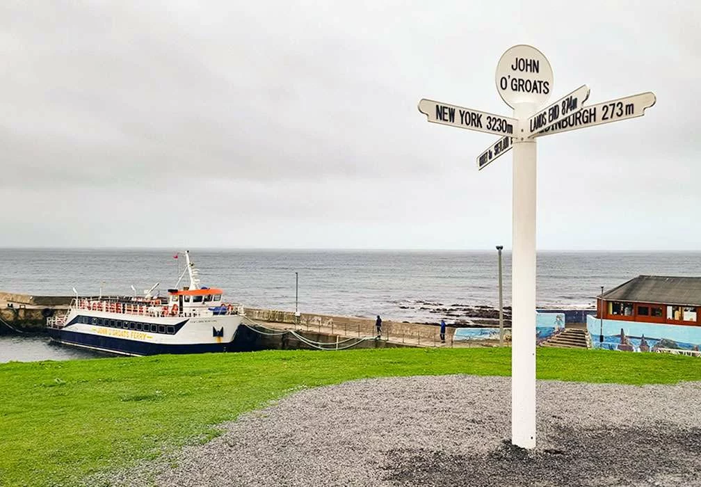
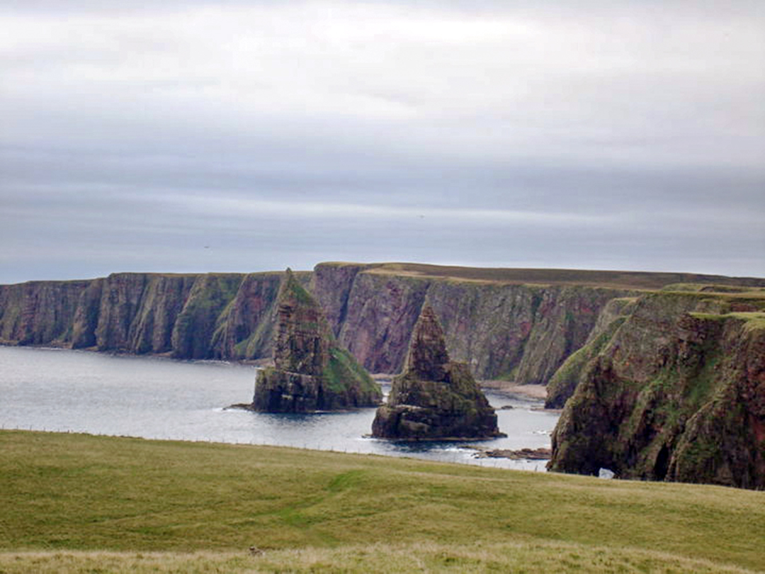
John o’ Groats to Duncansby Stacks, Caithness
Walk out from John o’ Groats along the Pentland Firth to Duncansby Head Lighthouse and the huge Duncansby Stacks, passing the sandy Bay of Sannick on the way.
This 5-mile (8 km) round trip follows the shore of the Pentland Firth, where the Atlantic meets the North Sea. Its tides are among the fastest in the world, and its tidal races are so notorious that sailors gave them names, like the Merry Men of Mey. Watch for seals, and puffins on the cliffs in early summer.
Distance: 5 miles / 8 km return · Difficulty: Easy · Best for: sea stacks, the end-of-Britain feeling · Don’t miss: the Duncansby Stacks · Where to eat: Stacks Coffee House at John o’ Groats
Hike the coastal walk to Duncansby Stacks and find more things to do in Caithness.
The Whaligoe Steps, Caithness
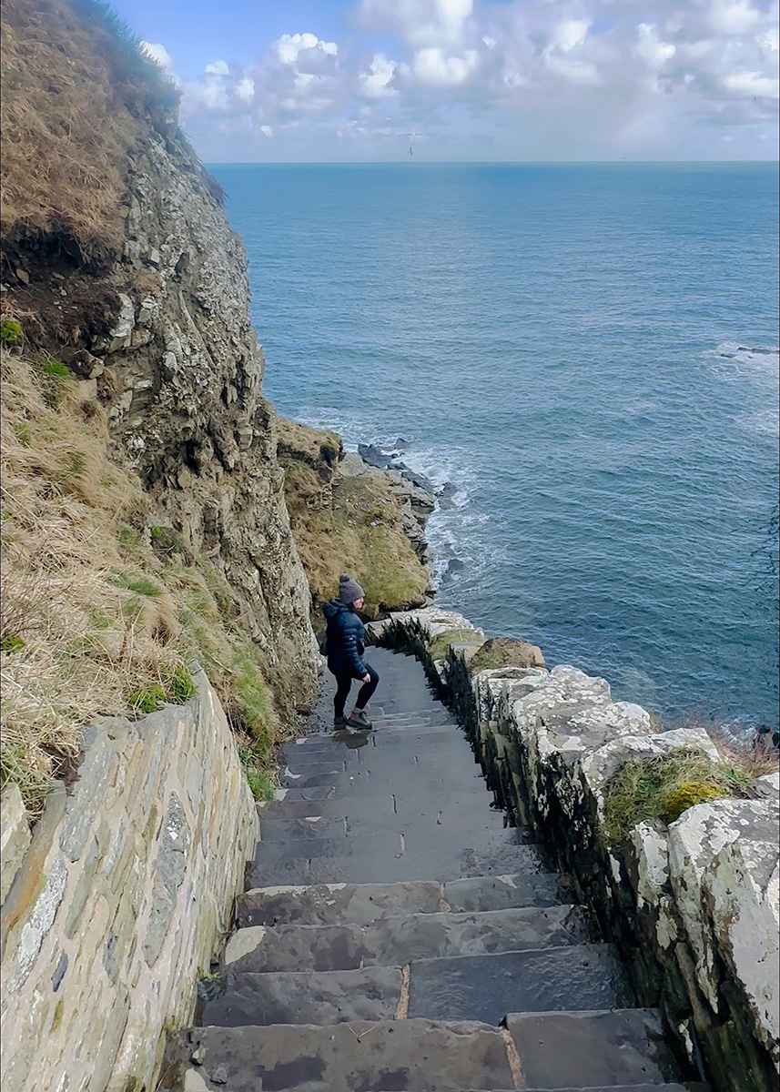
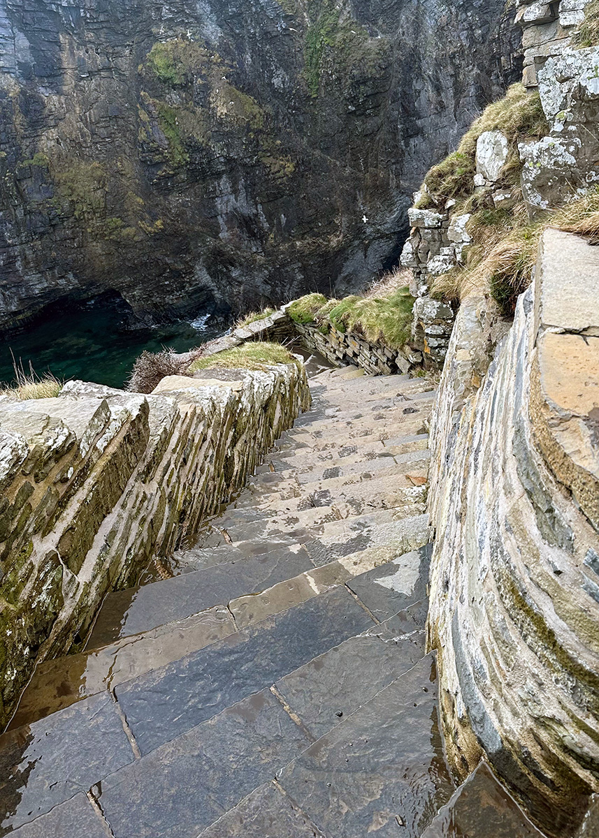
One of the strangest harbours in Scotland. South of Wick, a flight of flagstone steps zigzags down a sheer cliff to a tiny quay at the bottom of a narrow inlet. There are somewhere between 330 and 365 of them, depending on who’s counting.
In the 19th-century herring boom, fishing boats landed here and women carried the catch up the steps in creels. Going down is easy. Coming back up is another matter, so take it slowly, especially when the steps are wet.
The steps aren’t signposted from the main road. Look for the sign to the Cairn o’ Get on the A99 and take the small road opposite, towards the coast.
Distance: under half a mile return, but over 330 steps · Difficulty: Moderate (steep steps) · Best for: history, a short NC500 leg-stretch · Don’t miss: the view down into the haven from the top ·
Find more things to do in Caithness and walk the Whaligoe Steps.
Badbea clearance village, Caithness
One of the most moving places on the north-east coast. In the late 18th century, families evicted from the inland straths to make way for sheep were resettled here, on a steep, windswept slope above the sea cliffs. Local legend says children and livestock had to be tethered to stop them being blown over the edge.
A short circular path from the car park on the A9 leads through the ruins of the cottages to a monument, built in 1911 by the son of a Badbea family who had emigrated to New Zealand. Interpretation boards tell the story along the way. Keep well back from the cliff edges.
Distance: about 1.5 miles (2 km) circular · Difficulty: Easy to moderate (steep, uneven ground) · Best for: Highland history, clifftop views · Don’t miss: the 1911 monument · Where to eat: the River Bothy café in Berriedale (seasonal)
Walk to Badbea clearance village.
Golspie to Brora, Sutherland
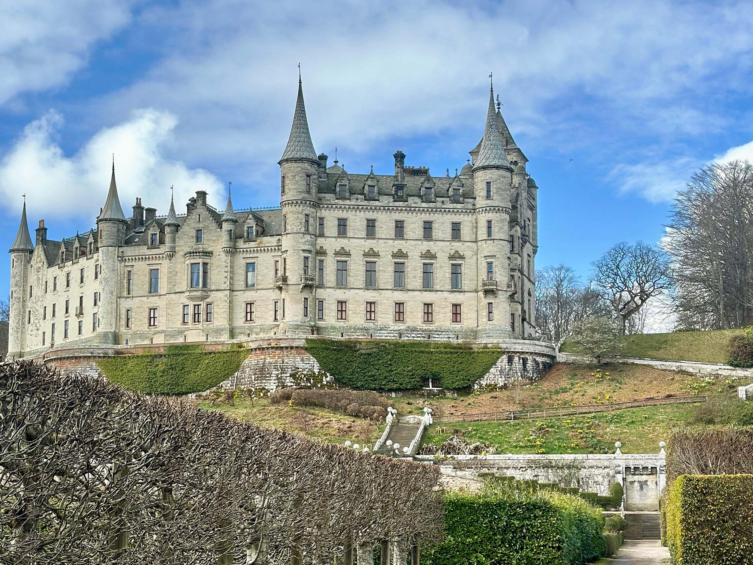
A varied and easy stretch of the John o’ Groats Trail, following the shore between two villages. Leaving Golspie, you pass right below the fairytale turrets of Dunrobin Castle, then Carn Liath, one of the best-preserved Iron Age brochs on the east coast, where you can walk inside the walls.
The rest of the way follows grassy paths and sandy beaches, with seals often hauled out on the rocks and a pretty waterfall on the Sputie Burn near Brora. Walk one way and catch the train back.
Distance: 6 miles one way (return by train) · Difficulty: Easy · Best for: castles, brochs, seals · Don’t miss: Carn Liath broch · Where to eat: the Coffee Bothy in Golspie
Walk from Brora to Golspie.
Dornoch beach to Embo, Sutherland
Dornoch is one of the prettiest small towns in the Highlands, with a sandstone cathedral and a famous links golf course. Below the golf course, a long, clean beach stretches north towards the village of Embo, backed by dunes.
Walk along the sand as far as Embo and back. Dolphins are sometimes seen offshore in the Dornoch Firth, and seals often haul out at the mouth of Loch Fleet, beyond Embo.
Distance: about 5 miles return · Difficulty: Easy · Best for: beach walking, families · Don’t miss: Dornoch Cathedral before or after · Where to eat: Dornoch
Walk the Dornoch links and Embo circular.
Tarbat Ness, Easter Ross
A coastal circuit of the Tarbat peninsula, which juts out between the Dornoch and Moray Firths. Start in the pretty fishing village of Portmahomack and follow the coast out to Tarbat Ness lighthouse, one of the tallest in mainland Britain, built by Robert Stevenson in 1830.
The route returns along the other side of the headland past the ruins of Ballone Castle. Seals, dolphins and seabirds are often seen offshore, and the peninsula is a hotspot for migrating birds in autumn. The outward section can be very muddy.
Distance: 8.75 miles (14 km) circular · Difficulty: Easy to moderate (muddy in places) · Best for: wildlife, lighthouses, a quiet corner of the NC500 · Don’t miss: Tarbat Ness lighthouse · Where to eat: the Castle Inn in Portmahomack
Walk the Tarbat Ness circuit.
Cromarty and McFarquhar’s Bed, Black Isle
Cromarty, at the tip of the Black Isle, is one of the best-preserved small towns in Scotland, full of Georgian merchants’ houses and fishermen’s cottages. From the shore, a coastal circuit heads east beneath the South Sutor, one of the two great headlands guarding the Cromarty Firth.
The walk leads to McFarquhar’s Bed, a natural rock arch and cave on the shore, and returns over the Sutor’s wooded slopes. Parts of the path cross muddy farmland, and the descent to the Bed is steep. Look out for bottlenose dolphins from the shore at Cromarty.
Distance: about 5 miles circular · Difficulty: Moderate (muddy fields and a steep descent) · Best for: dolphins, history, a quiet walk near Inverness · Don’t miss: McFarquhar’s Bed · Where to eat: Cromarty
Walk the Cromarty 100 Steps and Sutors.
Chanonry Point, Black Isle
The best place in Britain to watch bottlenose dolphins from the shore. Chanonry Point is a shingle spit that juts out into the Moray Firth between Fortrose and Rosemarkie, with a lighthouse at its tip. The Moray Firth’s resident dolphins often feed in the narrow channel just off the point, sometimes only metres from the beach.
Walk along the shore from Rosemarkie or Fortrose rather than trying to park at the point, which gets very busy. The best time to see dolphins is usually on a rising tide, roughly an hour after low tide.
Distance: about 3 miles return from Rosemarkie · Difficulty: Easy · Best for: dolphins, families, an easy stop near Inverness · Don’t miss: the dolphins on a rising tide · Where to eat: Rosemarkie or Fortrose
Walk to Chanonry Point from Fortrose.
Skye, the Hebrides and Arran
The King’s Cave, Isle of Arran
According to legend, this is where Robert the Bruce sheltered in 1306 and watched a spider try, and try again, to spin its web, inspiring him to fight on for Scotland’s independence. Several caves claim the story, but this one has the best setting.
From the Forestry car park north of Blackwaterfoot, a path runs through the forest and down to the shore, then along the raised beach below the cliffs to the cave, which has ancient carvings on its walls. Return through the forest to make a loop, with views over the Kilbrannan Sound to Kintyre.
Distance: about 3 miles circular · Difficulty: Easy to moderate · Best for: history, legends, families · Don’t miss: the carvings inside the cave · Where to eat: Blackwaterfoot
Walk the King’s Cave circuit.
Sannox to Lochranza and the Cock of Arran, Isle of Arran
The wildest section of the Arran Coastal Way follows the north-east coast of Arran, where there’s no road at all. From Sannox, the path winds through the Fallen Rocks, a jumble of boulders from an ancient landslip, past the lonely Laggan Cottage, to the Cock of Arran, a great sandstone boulder once said to look like a crowing cockerel.
Near Lochranza, look out for Hutton’s Unconformity, where the geologist James Hutton found evidence in the rocks for the immense age of the Earth. Some sections are rough, bouldery and narrow, especially around the Scriodan rockfall, and can be boggy. Take the bus back to Sannox.
Distance: about 10 miles (16 km) one way · Difficulty: Moderate to hard (bouldery, narrow sections) · Best for: experienced walkers, wildlife, geology · Don’t miss: Hutton’s Unconformity · Where to eat: Lochranza
Find out more at the Arran Coastal Way and walk from Sannox to Lochranza via the Cock of Arran.
The Isle of Gigha twin beaches
A small, community-owned island just 20 minutes by ferry from Tayinloan on Kintyre. From the ferry at Ardminish, a quiet road and track lead north to the Twin Beaches, two white-sand beaches back to back on either side of a narrow sandy neck, with views across to the Isle of Cara.
Gigha is easy to walk or cycle, and the Achamore Gardens, famous for their rhododendrons and azaleas, are worth a stop on the way back to the ferry.
Distance: about 4 miles return from the ferry · Difficulty: Easy · Best for: white sand, a relaxed island day · Don’t miss: the Twin Beaches · Where to eat: the Boathouse at Ardminish.
The Mull of Oa and the American Monument, Islay
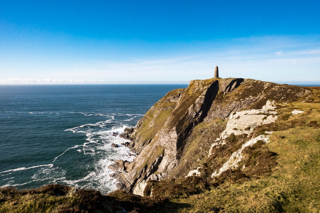
Islay’s south-west corner is the island’s most dramatic. From Port Ellen, drive out onto the remote Mull of Oa, where an RSPB reserve path leads along the Oa cliffs to the American Monument.
Look for golden eagles soaring overhead, and wild goats and Highland cows ambling across the path.
The monument, visible for miles, commemorates the loss of two troopships off Islay in 1918, the Tuscania and HMS Otranto. The story of those lost is truly humbling.
Distance: 2.5 miles return · Difficulty: Easy · Best for: eagles, dramatic cliffs, history · Don’t miss: the American Monument · Where to eat: the Old Kiln Cafe at Ardbeg Distillery
Walk to the Mull of Oa and the American Monument and plan your trip to Islay.
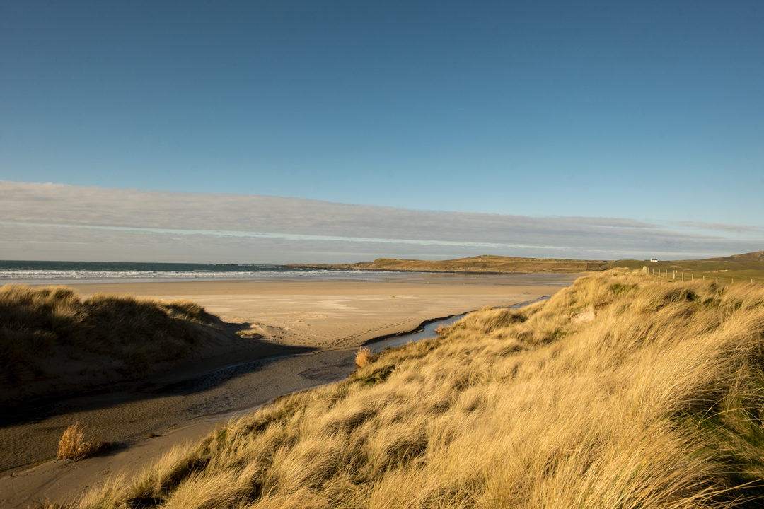
Machir Bay, Islay
Islay’s finest beach, a mile-long sweep of golden sand on the wild Atlantic coast near Kilchoman. Walk the length of the beach and back, with big waves rolling in from the west and dunes behind.
The currents here are dangerous, so it’s not a swimming beach. Combine the walk with the old Kilchoman church and its carved medieval cross nearby, and a visit to Kilchoman, Islay’s farm distillery.
Distance: about 2 miles along the beach and back · Difficulty: Easy · Best for: beach walking, sunsets, whisky · Don’t miss: the Atlantic surf · Where to eat: the café at Kilchoman Distillery.
Plan your trip to Islay
Kiloran Bay, Colonsay
Colonsay is one of the most peaceful islands in the Hebrides, and Kiloran Bay on its north-west coast is its most beautiful beach: a wide curve of golden sand between rocky headlands, with Atlantic rollers sweeping in.
For a longer walk, follow the track north from the bay to the remote beach at Balnahard, passing wild goats on the way. The ferry from Oban takes around two and a half hours, so Colonsay is best enjoyed with an overnight stay.
Distance: up to 7 miles return, including Balnahard · Difficulty: Easy to moderate · Best for: solitude, beaches, wildlife · Don’t miss: Kiloran Bay from the road above · Where to eat: the Colonsay Hotel.
The Marble Quarry walk, Iona
Iona is best known for its abbey, traditionally said to be the burial place of 48 Scottish kings. But the island also has one of the most beautiful short coastal walks in Scotland, and almost no day-trippers do it.
The walk to the old marble quarry on Iona’s south-east coast takes you past the abbey, across machair and onto a wild, rocky shore. Iona’s distinctive green-veined marble was quarried here until the early 20th century, and the rusting remains of the cutting machinery are still slowly returning to the sea. The same marble was used for the altar in Iona Abbey.
If you have time for a second walk, head to the Spouting Cave on the island’s west coast, where the sea blasts up through a hole in the rocks in rough weather.
Distance: 5 miles return · Difficulty: Moderate (rough underfoot in places) · Best for: machair flowers, escaping the abbey crowds, geology · Don’t miss: the abandoned quarry machinery · Where to eat: the St Columba Hotel or the Argyll Hotel near the ferry
Walk to Iona’s Marble Quarry.
The Carsaig Arches, Isle of Mull
One of the wildest coastal walks in the Hebrides. From Carsaig pier on Mull’s south coast, a rough path heads west beneath towering basalt cliffs, past the Nun’s Cave, whose walls are carved with early Christian crosses, to a pair of huge natural sea arches.
The going is hard: boulder fields, a rough and sometimes narrow path, and an exposed section near the arches that’s best avoided if you don’t have a head for heights. Look out for feral goats, golden eagles and otters. Allow most of a day.
Distance: about 7.5 miles (12 km) return · Difficulty: Hard, with rough ground and exposure · Best for: experienced walkers, wild coastline · Don’t miss: the Nun’s Cave carvings · Where to eat: take a picnic
Walk to the Carsaig Arches
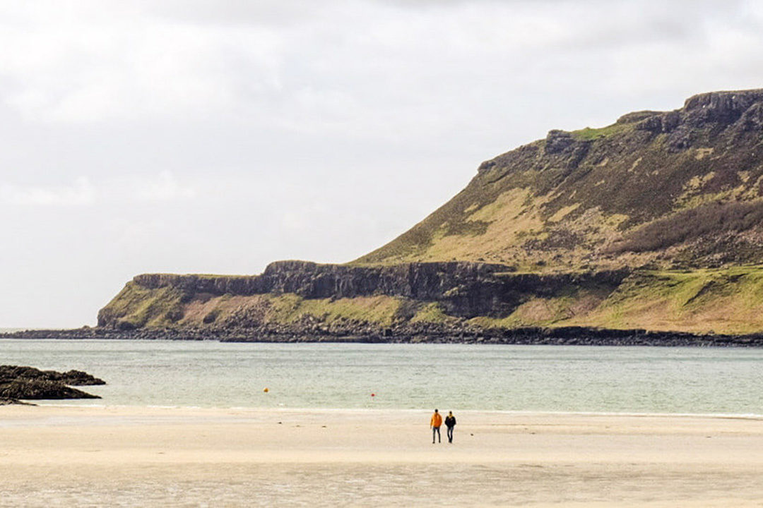
Calgary Bay, Isle of Mull
On Mull’s north-west coast, Calgary Bay is a crescent of white shell sand and turquoise water, backed by flower-filled machair. It’s the kind of beach that makes you wonder why anyone goes abroad.
Walk the beach, then climb the woodland trail above the bay at Calgary Art in Nature, where sculptures are hidden among the trees. Tobermory is about 40 minutes away.
Distance: about 2 miles, including the woodland trail · Difficulty: Easy · Best for: white sand, families, art · Don’t miss: the view back over the bay · Where to eat: Bring a picnic.
The Ringing Stone, Tiree
Tiree is one of the sunniest places in Britain, a flat island of white beaches, machair and big skies. On its north coast, a walk along the shore from Balephetrish leads to the Ringing Stone, a huge boulder covered in ancient cup marks that rings like metal when you tap it with a stone.
Legend says that if the stone ever breaks, Tiree will sink beneath the waves. Look out for seals on the rocks, and finish with a walk on one of Tiree’s many empty beaches.
Distance: about 3 miles return · Difficulty: Easy (rough shore) · Best for: a curiosity, seals, big skies · Don’t miss: the Ringing Stone · Where to eat: Scarinish
The Singing Sands, Isle of Eigg
Eigg is one of the Small Isles, a community-owned island famous for running on its own renewable electricity. On its north-west coast, the Bay of Laig and the Singing Sands (Camas Sgiotaig) have one of the most spectacular views in the Hebrides, across to the mountains of Rùm.
The quartz sand squeaks underfoot when it’s dry, hence the name. From the crofting township of Cleadale, it’s a short walk to the beach. From the pier, it’s around five miles, so hire a bike.
Distance: about 2 miles return from Cleadale · Difficulty: Easy · Best for: views to Rùm, island life · Don’t miss: the view of Rùm at sunset · Where to eat: the café at the pier.
Walk to the Singing Sands, Eigg
The Point of Sleat, Isle of Skye
The southernmost tip of Skye. From the road end at Aird of Sleat, a rough track and path cross moorland to a sheltered cove with white sand and a small jetty, then on to a little lighthouse at the point.
The views take in Eigg, Rùm and the mountains of Knoydart and Ardnamurchan. It’s a quiet, easy-going walk on the gentler side of Skye, and often empty even when the north of the island is busy.
Distance: 5.5 miles (9 km) return · Difficulty: Easy to moderate · Best for: a quiet corner of Skye, views to the Small Isles · Don’t miss: the sandy cove below the lighthouse · Where to eat: Armadale, on the way back
Walk to the Point of Sleat.
Boreraig and Suisnish, Isle of Skye
A long but straightforward circuit to two coastal villages cleared of their people in the 1850s to make way for sheep. From the ruined church of Cill Chriosd on the Broadford to Elgol road, an old track crosses the hill to the ruins of Boreraig, on the shore of Loch Eishort.
The path then follows the coast to Suisnish and returns via Camas Malag, with views to the Cuillin. The ruined houses and field walls make it a deeply affecting walk. For a shorter day, walk to Boreraig and back (about 6 miles).
Distance: 10.25 miles (16.5 km) circular, or 6 miles return to Boreraig · Difficulty: Moderate · Best for: history, solitude · Don’t miss: the ruins at Boreraig · Where to eat: Broadford
Walk Boreraig and Suisnish.
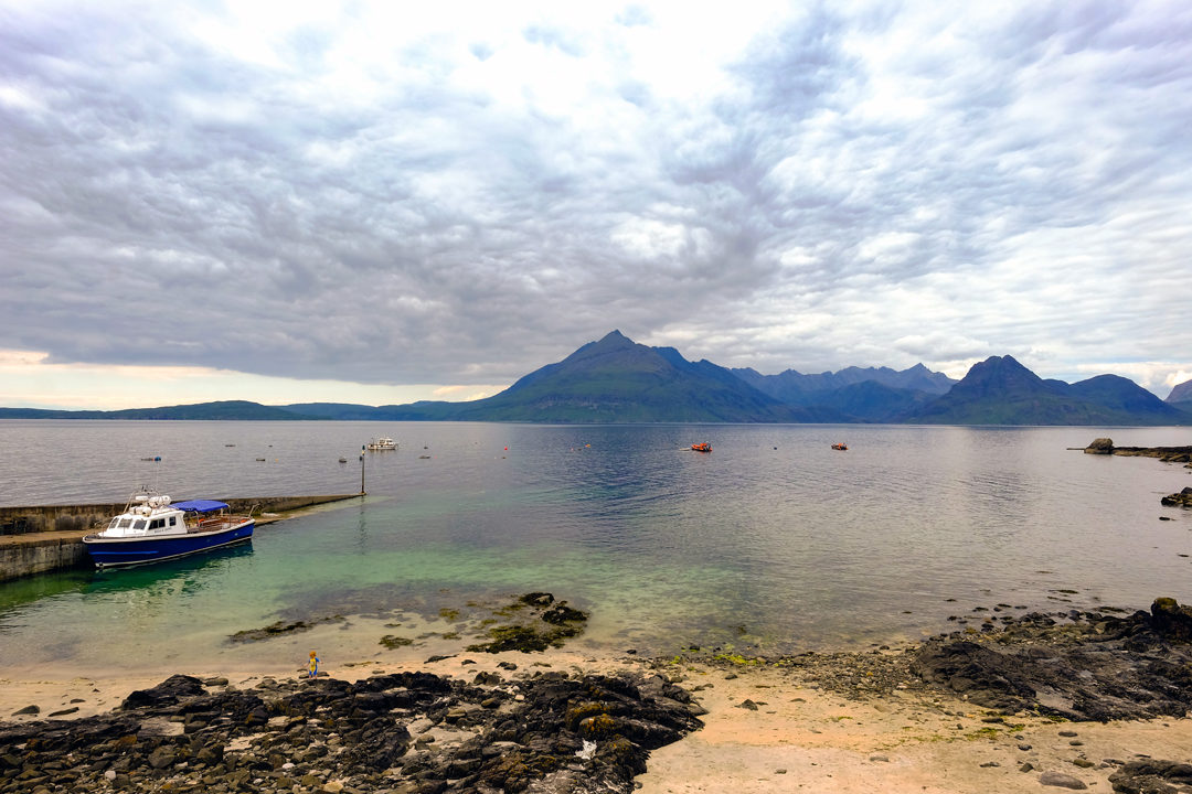
Elgol to Camasunary, Isle of Skye
Elgol has one of the most famous views in Scotland: the jagged Black Cuillin rising straight out of Loch Scavaig. From the village, a coastal path follows the clifftops north to Camasunary, a green bay and bothy at the foot of the mountains.
The path is narrow in places, with steep drops, so it isn’t one for anyone nervous of heights, or for young children. For an easier taste, walk the first mile out of Elgol to the grassy headland and back. You can also take a boat trip from Elgol to Loch Coruisk, in the heart of the Cuillin.
Distance: about 8 miles return to Camasunary · Difficulty: Moderate to hard (narrow, exposed sections) · Best for: Cuillin views, experienced walkers · Don’t miss: the view of the Cuillin from Elgol · Where to eat: Elgol
Walk to Camasunary on the Elgol peninsula circuit.
Talisker Bay, Isle of Skye
Not the distillery, which is a few miles away at Carbost, but the wild bay it’s named after. From the road end, a track leads past Talisker House to a beach of black and white sand, with a sea stack at one end and a waterfall tumbling off the cliffs at the other.
It’s one of the best sunset walks on Skye. Combine it with a tasting at the Talisker Distillery on the way.
Distance: about 2 miles return · Difficulty: Easy · Best for: sunsets, photography · Don’t miss: the waterfall · Where to eat: the Oyster Shed at Carbost
Walk to Talisker Bay.
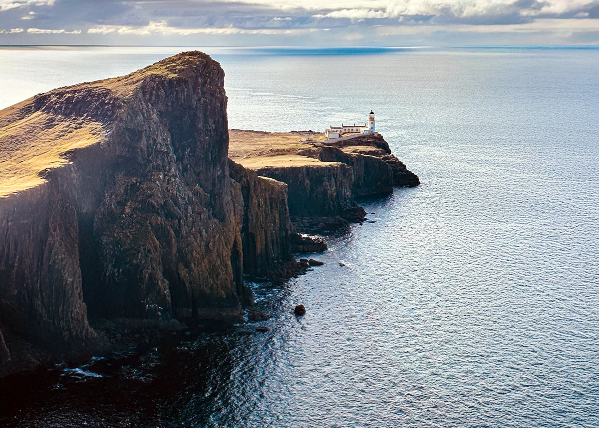
Neist Point, Isle of Skye
Skye’s most westerly point, and one of its most famous views. A concrete path, steep in places, drops down from the car park and runs out along a narrow finger of land to the lighthouse at its tip, with sheer cliffs on either side.
Whales, dolphins and basking sharks are sometimes seen offshore in summer. For the classic photo of the lighthouse, walk up the hill to the right of the car park instead. It’s one of the best sunset spots on the island.
Distance: 1.5 miles return · Difficulty: Easy to moderate (steep steps back up) · Best for: sunsets, photography, whale watching · Don’t miss: the view of the lighthouse from the clifftop · Where to eat: take a picnic, or head back to Glendale
Read more: island-hopping on Scotland’s west coast and walk to Neist Point.
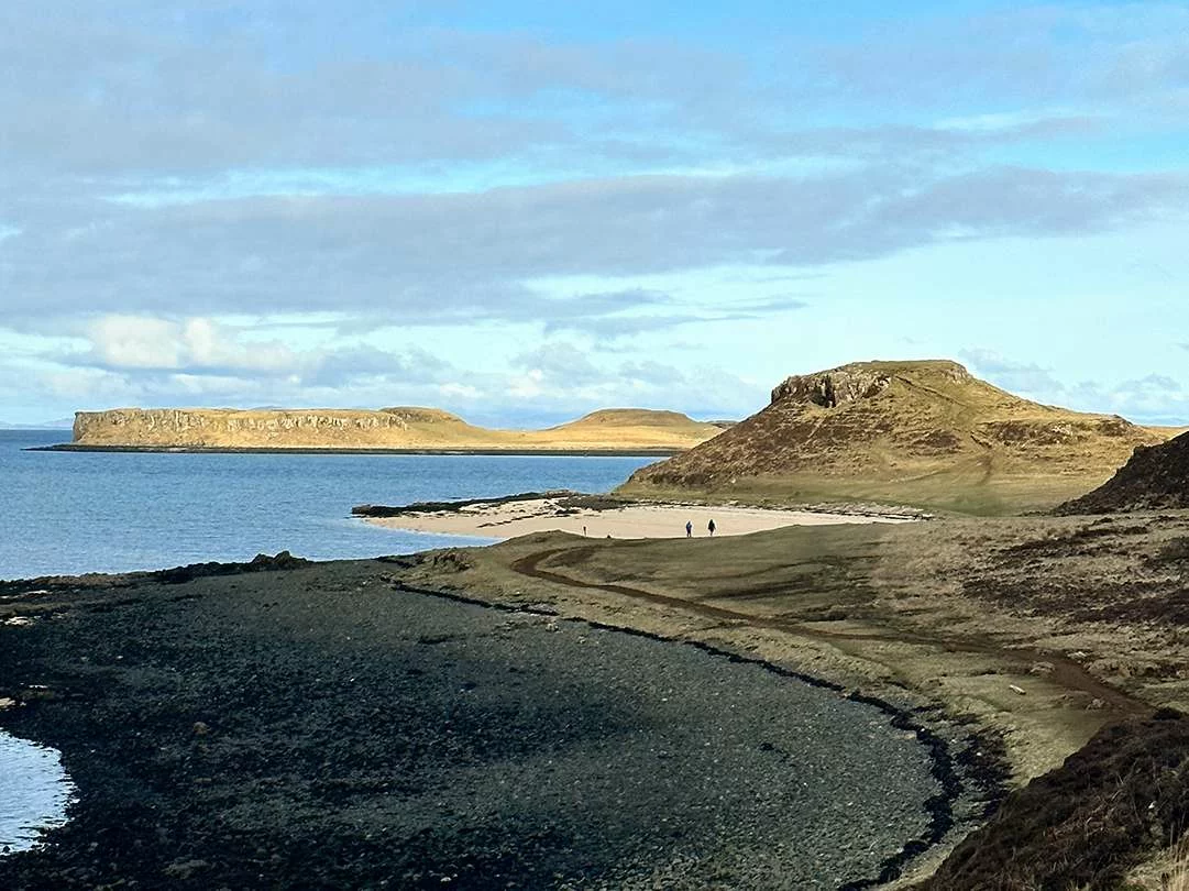
The Coral Beach, Isle of Skye
A short, easy walk from Claigan, north of Dunvegan, to a beach that glows white and turquoise in the sun. It isn’t actually coral. The beach is made of maerl, the bleached skeletons of a red seaweed, which crunches underfoot.
Climb the small hill at the end of the beach for views over Loch Dunvegan to the Outer Hebrides, and look out for seals on the rocks. Combine it with a visit to Dunvegan Castle on the way back.
Distance: 2 miles return · Difficulty: Easy · Best for: families, a Caribbean-coloured beach · Don’t miss: the view from the hill above the beach · Where to eat: Dunvegan
Walk to the Coral Beaches at Claigan.
Rubha Hunish, Isle of Skye
The northernmost tip of Skye, and one of the island’s best-kept secrets. From Duntulm, a path crosses moorland to a clifftop above the headland, where an old coastguard lookout has been restored as a tiny bothy with windows facing out to sea.
It’s one of the best places on Skye to spot whales and dolphins. A steep, rocky path scrambles down the cliff to the headland itself, but the views from the lookout are just as good if you’d rather stay on top.
Distance: about 5.5 miles return · Difficulty: Moderate (steep descent to the headland) · Best for: whale watching, solitude · Don’t miss: the old coastguard lookout · Where to eat: take a picnic
Walk to Rubha Hunish.
The Vatersay beaches
At the southern end of the Outer Hebrides, the island of Vatersay is joined to Barra by a causeway. At its narrow waist, two white-sand beaches sit back to back, one facing east and one facing the Atlantic, with a strip of flower-filled machair between them.
Walk from one beach to the other and back along the dunes. Near the Atlantic beach, a memorial marks the wreck of the Annie Jane, an emigrant ship lost here in 1853 with hundreds of lives.
Distance: about 2 miles, between the two beaches · Difficulty: Easy · Best for: white sand, machair flowers, solitude · Don’t miss: the Annie Jane memorial · Where to eat: Castlebay on Barra
Read more: the Outer Hebrides outdoor guide and walk to the Vatersay Beaches
West Beach, Berneray
Berneray, joined to North Uist by a causeway, has one of the finest beaches in the Outer Hebrides: three miles of white sand along its Atlantic coast, backed by dunes and machair.
Walk the length of the beach and return over the machair, which is carpeted in wildflowers in early summer. You’ll very likely have it all to yourself. The ferry to Harris leaves from Berneray too.
Distance: up to 6 miles, the beach and back over the machair · Difficulty: Easy · Best for: solitude, beaches, machair flowers · Don’t miss: the machair in June and July · Where to eat: take a picnic
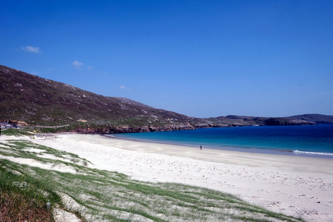
Huisinis, North Harris
At the end of a long, winding single-track road through North Harris, past the grand Amhuinnsuidhe Castle, lies Huisinis, a tiny settlement with a white-sand beach looking out to the island of Scarp.
From the road end, walk north over the machair and rocks to the beautiful beach at Traigh Mheilein, with views across the sound to Scarp, returning the same way.
Distance: about 3 miles return · Difficulty: Easy to moderate · Best for: solitude, beaches, the drive in · Don’t miss: the view to Scarp · Where to eat: take a picnic, or head back to Tarbert
Read more: the Outer Hebrides outdoor guide and walk to Tràigh Mheilein from Huisinis.
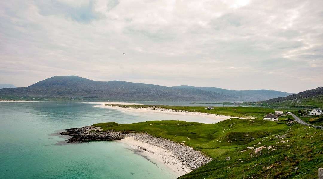
Luskentyre, Isle of Harris
Regularly named one of the best beaches in Britain, Luskentyre is a vast expanse of white sand and impossibly blue water on the west coast of Harris, looking across to the island of Taransay.
There’s no set route. Walk out from the parking area through the dunes and along the sand for as far as the tide allows. At low tide the sands stretch for miles across the estuary.
Distance: up to 4 miles along the sand · Difficulty: Easy · Best for: beach walking, photography · Don’t miss: the view to Taransay · Where to eat: Tarbert, 20 minutes away
Read more: the Outer Hebrides outdoor guide and walk Luskentyre Sands.
Gearrannan to Dalmore and Dalbeg, Isle of Lewis
Start at the Gearrannan Blackhouse Village, a cluster of restored thatched cottages on the Atlantic coast of Lewis, lived in until as recently as 1974. From the village, a waymarked path climbs over the clifftops to the beautiful beach at Dalmore, then on to Dalbeg.
The path is faint and boggy in places, with unprotected clifftops, and there’s a fair amount of up and down. Keen walkers can continue to Shawbost, 8 miles in all. The bus back is infrequent, so check times before you set off.
Distance: 4 miles one way to Dalbeg, or 8 miles to Shawbost · Difficulty: Moderate (boggy, unfenced cliffs) · Best for: history, beaches · Don’t miss: the blackhouse village · Where to eat: the café at Gearrannan
The Butt of Lewis, Isle of Lewis
The northern tip of the Outer Hebrides, where a red-brick lighthouse stands above cliffs pounded by the Atlantic. Walk along the clifftops from the lighthouse to watch the waves and the seabirds, with nothing between you and the Arctic.
For a longer walk, follow the coast from the lighthouse to Port of Ness, a small harbour with a sandy beach. Look out for fulmars, gannets and, in summer, puffins.
Distance: 1 mile of clifftop from the lighthouse, or about 5 miles return from Port of Ness · Difficulty: Easy · Best for: big seas, seabirds · Don’t miss: the lighthouse · Where to eat: Port of Ness
Walk the Butt of Lewis circuit from Eoropie.
Orkney and Shetland
The Old Man of Hoy, Orkney
Britain’s most famous sea stack. The Old Man of Hoy rises from the sea off the west coast of Hoy, and you can walk to a viewpoint opposite it from the tiny settlement of Rackwick.
A good path climbs gently out of Rackwick and follows the clifftops for just under three miles to the viewpoint, with views back over Rackwick Bay and across the Pentland Firth to the mainland. Getting to Hoy takes planning: a passenger ferry from Stromness or a car ferry from Houton, then a drive or taxi across the island.
Distance: about 6 miles return from Rackwick · Difficulty: Moderate · Best for: the most famous sea stack in Britain · Don’t miss: the view back over Rackwick Bay · Where to eat: take a picnic
Visit The Old Man of Hoy
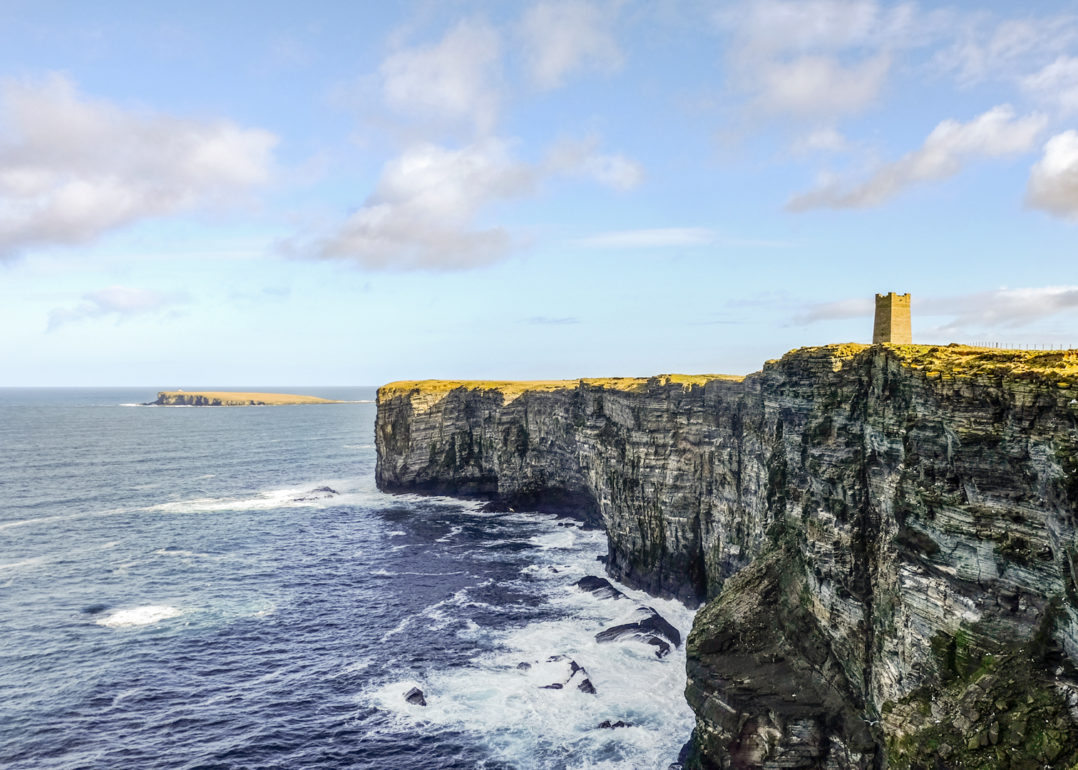
Yesnaby cliffs, Orkney
The west coast of Orkney’s Mainland is lined with some of the most dramatic cliffs in Scotland, and Yesnaby is the best place to see them. From the car park beside old Second World War buildings, walk south along the clifftops to Yesnaby Castle, a sea stack with a hole through its base.
The cliffs are unfenced and the wind can be ferocious, so keep well back from the edge. In early summer, look for the rare Scottish primrose, which grows only on these northern coasts.
Distance: about 3 miles return · Difficulty: Moderate (unfenced cliffs) · Best for: sea stacks, wild weather, flowers · Don’t miss: Yesnaby Castle · Where to eat: Stromness, 15 minutes away
Visit Yesnaby
Marwick Head, Orkney
On the west coast of Orkney’s Mainland, the sheer cliffs of Marwick Head are an RSPB reserve, packed with nesting guillemots, razorbills, kittiwakes and a few puffins in early summer.
On the clifftop stands the Kitchener Memorial, commemorating the loss of HMS Hampshire, which struck a mine offshore in 1916 with Lord Kitchener on board. A memorial wall beside the tower lists all those who died. The clifftops are unfenced, so keep well back.
Distance: about 2 miles return · Difficulty: Moderate (unfenced cliffs) · Best for: seabirds, history · Don’t miss: the Kitchener Memorial · Where to eat: Birsay or Stromness
Visit Marwick Head
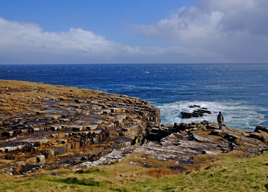
The Brough of Birsay, Orkney
A tidal island off the north-west tip of Orkney’s Mainland, reached by a concrete causeway that only appears at low tide. On the island are the remains of Pictish and Viking settlements and a Norse church, with a small lighthouse on the far side and puffins on the cliffs in summer.
The causeway is only passable for around two hours either side of low tide, and the tide comes in fast. Check the times before you cross (the Skara Brae visitor centre can advise) and leave plenty of time to get back. There’s a charge to visit the island’s historic site in summer.
Distance: about 2 miles, including the causeway and a loop of the island · Difficulty: Easy, but tidal · Best for: history, puffins, rock pools · Don’t miss: the Viking houses · Where to eat: Birsay village
Visit the Brough of Birsay.
Sumburgh Head, Shetland
The southern tip of Shetland’s Mainland, and the easiest place in Scotland to see puffins up close. A short, steep road climbs from the car park to the lighthouse, and the puffins nest in the grassy cliff tops right beside the walls, often just a few metres away.
The lighthouse buildings house a visitor centre, and the cliffs are an RSPB reserve. Puffins are here from roughly May to early August. Look out for whales and orcas offshore too.
Distance: about 1 mile return · Difficulty: Easy · Best for: puffins, lighthouses, families · Don’t miss: the puffins on the clifftop · Where to eat: the café at the lighthouse visitor centre.
Walk to Sumburgh Head from Jarlshof.
St Ninian’s Isle, Shetland
A small green island joined to Shetland’s Mainland by a perfect ribbon of white sand, known as a tombolo, with the sea on both sides. Walk across the sand and follow the path around the island’s clifftops.
The island is also famous for the St Ninian’s Isle treasure, a hoard of Pictish silver found by a schoolboy at the ruined chapel in 1958. Replicas are on show in the Shetland Museum in Lerwick.
Distance: about 3 miles, including the tombolo and a loop of the island · Difficulty: Easy · Best for: beaches, history, photography · Don’t miss: the view of the tombolo from above · Where to eat: take a picnic
Walk the St Ninian’s Isle circular.
The Isle of Noss, Shetland
One of the finest seabird colonies in Europe. From Lerwick, take the car ferry to Bressay, cross the island to Noss Sound, and a warden brings you across to Noss in a small inflatable boat.
A walk around the island leads up to the Noup of Noss, where 181-metre cliffs are home to tens of thousands of gannets, guillemots and puffins in summer, a true seabird skyscraper. The Noss boat runs daily from May to late August, except Mondays and Thursdays, and only when the sea allows. Dogs aren’t allowed on the island.
Distance: 5 miles (8 km) circuit · Difficulty: Moderate · Best for: seabirds, wildlife photography · Don’t miss: the gannets at the Noup of Noss · Where to eat: take a picnic, there are no refreshments on Noss
Visit The Isle of Noss
Eshaness cliffs, Shetland
On the far north-west coast of Shetland’s Mainland, the Eshaness cliffs are the remains of an ancient volcano, carved by the Atlantic into stacks, arches and blowholes. Start at the lighthouse and walk north along the clifftops.
On the way you’ll pass the Holes of Scraada, a collapsed sea cave that has left a deep hole in the ground some distance from the sea, before reaching the Grind o da Navir, a huge natural gateway in the cliffs where storm waves have tossed boulders high onto the clifftop.
Distance: about 4 miles return from the lighthouse · Difficulty: Moderate (unfenced cliffs) · Best for: wild coastline, geology · Don’t miss: the Grind o da Navir · Where to eat: the Braewick Café, on the road to Eshaness.
Walk Eshaness Cliffs
Hermaness, Unst, Shetland
The northernmost walk in the UK. On the island of Unst, two ferry crossings from Shetland’s Mainland, a path and boardwalk crosses the moorland of the Hermaness National Nature Reserve to clifftops teeming with gannets and puffins.
From the top you look out to Muckle Flugga, a rocky stack crowned by Britain’s most northerly lighthouse, and beyond it to Out Stack, the last speck of land before the Arctic. Great skuas (bonxies) nest on the moor and will dive at you if you stray from the path.
Distance: about 5 miles (8 km) return, or 7.5 miles with the coastal extension · Difficulty: Moderate · Best for: seabirds, the end-of-Britain feeling · Don’t miss: the view to Muckle Flugga · Where to eat: take a picnic
Walk to Hermaness.
Scotland’s long-distance coastal paths
If you want to walk for days rather than hours, Scotland’s long-distance coastal paths link many of the walks above into multi-day routes. Most are part of Scotland’s Great Trails, a collection of well-managed, waymarked routes.
The Fife Coastal Path
One of Scotland’s longest coastal paths runs 117 miles from Kincardine on the Firth of Forth round to Newburgh on the Firth of Tay. Fishing villages, white-sand beaches, St Andrews and the seals at Tentsmuir. It breaks easily into shorter sections from any of the East Neuk villages. Find out more at the Fife Coast and Countryside Trust.
The Ayrshire Coastal Path
A 100-mile route along the Firth of Clyde from Glenapp, near Ballantrae, north to Skelmorlie near Largs. Castles (Culzean, Dunure, Greenan), Robert Burns country and big views to Arran and Kintyre. The Mull of Galloway Trail adds around 35 more miles south to Scotland’s most southerly point. Find out more at the Ayrshire Coastal Path.
The Kintyre Way
A 100-mile route down the Kintyre Peninsula from Tarbert to Machrihanish. Beaches, distilleries (Springbank in Campbeltown) and big Atlantic views to Islay, Jura and Arran. Less famous than the Fife Coastal Path, but quieter and arguably more spectacular. Find out more at the Kintyre Way.
The Arran Coastal Way
A 65-mile circuit of the Isle of Arran. Mountains, beaches, the King’s Caves where Robert the Bruce is said to have hidden, and Holy Isle just offshore. A week-long walk that lets you experience “Scotland in miniature” properly. Find out more at the Arran Coastal Way.
The Moray Coast Trail
A 50-mile trail from Forres to Cullen along the Moray Firth, with painted beach huts at Hopeman, dolphin watching at Spey Bay and the fishing village of Findochty. Mostly easy, flat walking with regular pub stops. Find out more at Moray Ways.
The Berwickshire Coastal Path
A 30-mile path from Cockburnspath south to Berwick-upon-Tweed in England, with some of the most spectacular cliff scenery on the British east coast. St Abbs Head, Eyemouth and Coldingham Bay are the highlights. It links to the Northumberland Coast Path at Berwick. Find out more at the Berwickshire Coastal Path.
The Cape Wrath Trail
The most extreme long-distance walk in Scotland: a 230-mile, mostly unwaymarked route from Fort William through Knoydart, Kintail, Torridon and Assynt to Cape Wrath. It’s more wild country than coast, but it touches the sea at Knoydart and ends on the cliffs at the north-west tip of Britain. Not for beginners. Find out more at the Cape Wrath Trail.
The John o’ Groats Trail
A 147-mile coastal route from Inverness to John o’ Groats, usually walked in about 14 stages over a fortnight. The southern half follows beaches, dunes and firths past Tain, Dornoch and Golspie. The northern half, beyond Helmsdale, is wild clifftop walking past ruined castles, sea stacks and hidden harbours like Whaligoe, and is rough, remote and sometimes pathless. Find out more at the John o’ Groats Trail.
Coast to coast walks in Scotland
Scotland has two classic coast to coast routes.
The Southern Upland Way is the big one: 214 miles from Portpatrick on the Irish Sea to Cockburnspath on the North Sea, across the hills of Dumfries and Galloway and the Scottish Borders. It’s one of Scotland’s toughest long-distance trails. Find out more at the Southern Upland Way.
The John Muir Way is a gentler 134-mile coast to coast from Helensburgh in the west to Dunbar in the east, the birthplace of John Muir, the Scots-born father of America’s national parks. Its eastern half, through Blackness Castle, South Queensferry, Edinburgh, North Berwick and on to Dunbar, is largely coastal. Find out more at johnmuirway.org.
Tips for coastal walking in Scotland
- Check the tides. Tidal causeways at Cramond Island and the Brough of Birsay, tidal bays like Aberlady, and the Elie Chain Walk can all cut you off on a rising tide. Look up tide times before you set out.
- Keep back from cliff edges, especially in wind. Clifftop paths at places like Yesnaby, Eshaness and the Bullers of Buchan are unfenced and can be crumbly.
- Check ferries before you go. Handa, Kerrera, Hoy, Unst and Cape Wrath all need a boat, some ferries only run in spring and summer, and all small boats are weather-dependent.
- Watch for military ranges. Cape Wrath and Faraid Head are used by the Ministry of Defence. Follow the signs and check firing times.
- Expect no phone signal in the far north-west and on the islands. Tell someone your route and carry a map.
- Know the Scottish Outdoor Access Code. You have a right to roam, but keep dogs under control near livestock and ground-nesting birds, and take all your litter home.
- Pack midge repellent from June to September. Here’s my midge survival guide.
FAQs
What is the most beautiful coastal walk in Scotland?
Sanna Bay on the Ardnamurchan Peninsula and Sandwood Bay in Sutherland are two of the most beautiful coastal walks in Scotland, both ending at spectacular beaches. For cliffs and sea stacks, the Old Man of Hoy in Orkney and Eshaness in Shetland are hard to beat. On the east coast, the Fife Coastal Path through the East Neuk villages is the prettiest village-to-village walk.
Is there a coastal path around Scotland?
No. Unlike Wales and England, Scotland has no single path around its whole coast. Instead it has a network of coastal trails, including the John o’ Groats Trail, the Fife Coastal Path, Ayrshire Coastal Path, Kintyre Way, Moray Coast Trail and Berwickshire Coastal Path.
What is the longest coastal path in Scotland?
The John o’ Groats Trail is the longest, following the coast for 147 miles from Inverness to John o’ Groats. The Fife Coastal Path runs 117 miles from Kincardine to Newburgh, and the Ayrshire Coastal Path and the Kintyre Way are each around 100 miles.
What is the best easy coastal walk in Scotland?
The Fife Coastal Path through the East Neuk villages of Elie, St Monans, Pittenweem, Anstruther and Crail. Each village is 2 to 4 miles from the next on a flat, well-marked path, with cafés and pubs at every stop.
What are the best coastal walks on the Scottish islands?
Neist Point, the Coral Beach and the Point of Sleat on Skye, Davaar Island off Kintyre, Luskentyre on Harris, the Old Man of Hoy and the Brough of Birsay in Orkney, and Hermaness and Sumburgh Head in Shetland are some of the best. Closer to the mainland, the Isle of Kerrera is a short ferry ride from Oban, and the King’s Cave on Arran is an easy day trip from Glasgow.
Where can you see puffins on a coastal walk in Scotland?
Sumburgh Head, Hermaness and the Isle of Noss in Shetland, Marwick Head in Orkney, Handa Island in Sutherland, the Brough of Birsay in Orkney and Dunnet Head in Caithness are all good places to see puffins, usually from May to early August.
What are the best coastal walks near Edinburgh?
North Berwick to Tantallon Castle is the easiest “wow factor” walk, just 35 minutes from Edinburgh by train. Cramond Island is on the edge of the city, but check the safe crossing times first. Kinneil to Blackness Castle, Aberlady Bay to Gullane Point, and St Abbs to Coldingham Bay are all within an hour.
What are the best coastal walks near Glasgow?
Portencross Castle and Dunure to Culzean Castle are both about an hour away. For a longer trip, take the train and ferry to Arran for the King’s Cave or the Arran Coastal Way, or head to Tighnabruaich on the Cowal Peninsula.
When is the best time for coastal walks in Scotland?
May, June and September. You get long days, fewer midges than in high summer, drier ground than in early spring, and most ferries running. May to July is best for seabirds and puffins. Winter walks can be dramatic, but exposed coasts are battered by Atlantic storms and many island ferries run a reduced timetable.
Are there coastal walks for beginners in Scotland?
Yes. The East Neuk villages on the Fife Coastal Path, Aberdour to Burntisland, Yellowcraig, St Abbs to Coldingham Bay, Rockcliffe to Kippford, Chanonry Point, the Coral Beach on Skye and St Ninian’s Isle in Shetland are all short, easy routes that suit beginners and families.
You might also like
- The best walks in Fife
- The best loch walks in Scotland
- The best forest walks in Scotland
- The best short walks in Scotland
- The best circular walks in Scotland
- The best waterfall walks in Scotland
Which are your favourite coastal walks in Scotland?
Love from Scotland x

Leave a Reply