
Welcome to the Pentland Hills.
Does your city have beauty spots only really known to the locals? The places you go to get away from the manic hustle and bustle? Ask an Edinburgh local where they head on a Sunday for a walk, and the Pentland Hills Regional Park will be high on the list. Here’s how to explore Edinburgh’s Pentland Hills.
Fancy a weekend in the Pentland Hills? Stay at Eastside Cottages
My favourite walks in the Pentland Hills
If you fancy getting out for a walk in Scotland, you don’t have to head to the Highlands to get up into the hills. Directly to the south west of Edinburgh and spans Midlothian and West Lothian, the Pentlands covers 50 sqm miles of hills and nine reservoirs. Here are my favourite walks in the Pentlands.
1 / The Great Glen Mystery Walk
The Great Glen Mystery Walk is a 2-mile ramble (which can be shortened to a mile) from the Flotterstone car park up to Glencourse Reservoir. The mystery? A signed posted route with lots of clues to reveal what was returned to the Pentland Hills Regional Park in 1998.
- Route – Great Glen Mystery Walk
- Start – Flotterstone
- Distance – 2 miles
- Bus – Stagecoach bus 101 or 102 (Biggar) to the Flotterstone Inn
- Park – the Regional Park car park behind the Inn.

2 / The Torduff Water Walk
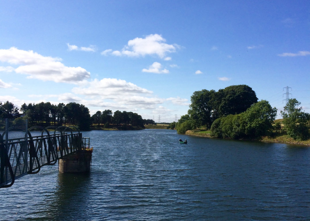
The Torduff Water Walk takes you on a 2 miles circular around Torduff & Clubbiedean reservoirs, both managed by Scottish Water. Clubbiedean has tree-lined banks and lots of fishermen going about their quiet business.
As with all walks in the Pentlands Hills, the views across to Edinburgh are spectacular – and in late summer the area blooms with purple heather. If you are feeling a little more energetic you can tag on a walk up and around the Bonaly Country Park to make this a good 4-mile stomp.
- Route –Torduff Water Walk
- Start – Bonaly
- Distance – 4 miles
- Bus – Lothian Bus no 10 to Bonaly Avenue
- Park – car park at the end of Bonaly Road
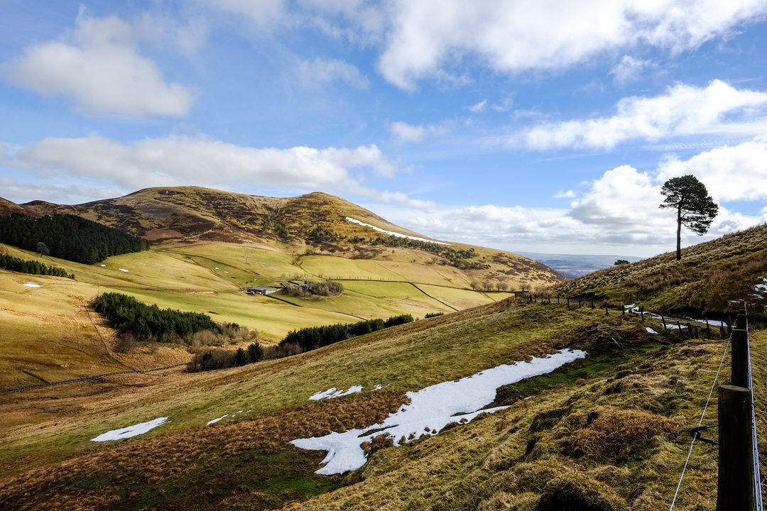
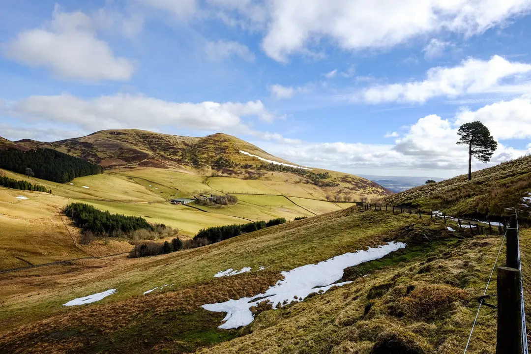
3 / Nine Mile Burn and Caps Law
Follow part of an old ‘Monk’s Route’ (which ran from Newhill Monastery to South Queensferry on a circular route into the Pentland Hills. This 4 mile path takes you up over Monks Ridge and Caps Law to the foot of the Kips before returning underneath Braid Law. You can also follow the Monk’s route all the way to Balerno.
- Route – Nine Mile Burn
- Start – Nine Mile Burn
- Distance – 4 miles
- Bus – Stagecoach bus 101 or 102 (Biggar)
- Park – park at Nine Mile Burn

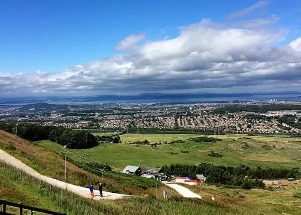

4 / The Capital View Walk
The Capital View Walk explores Hillend Country Park. Starting with a steep sharp climb up Hillend Hill – thankfully there is wee a bench at the top, you can either be brave and carry on up Caerketton Hill or take the path along the top of the ski-slope.
You then wind your way back down, taking in the amazing 180-degree views of Edinburgh, from the Bridges to the west, past the Castle and Arthur’s Seat to North Berwick law out to the far west.
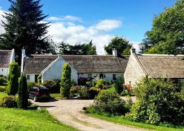
Back down in the valley, the path passes by tiny conservation village of Swanston before returning to the Hillend dry ski slope. Built as a farming community, these gorgeous thatched cottages were once council houses. Now privately owned they are beautifully kept, with gorgeous gardens. The walk is around 2 miles and will take 1-2 hours.
- Route – Capital View Walk
- Start – Hillend Dry Ski Slope
- Distance – 2.5 miles
- Bus – Lothian Bus no. 4
- Park – park at Hillend Dry Ski Slope


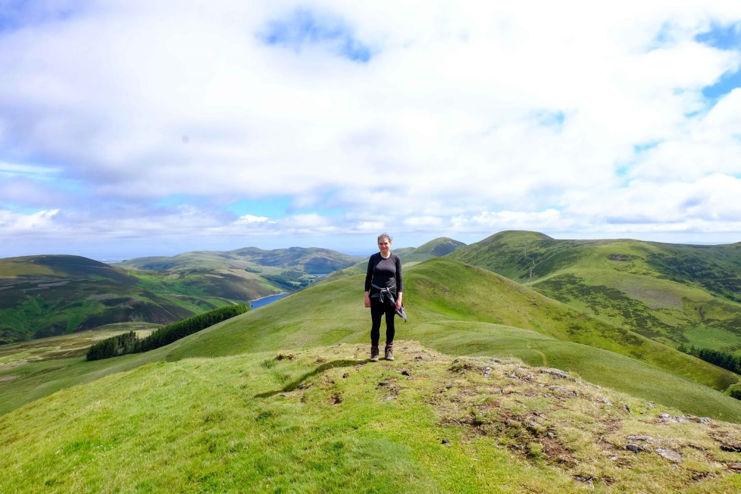
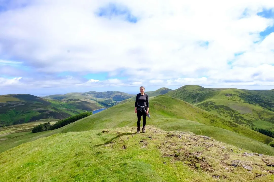
5 / The Five Peaks in the Pentlands
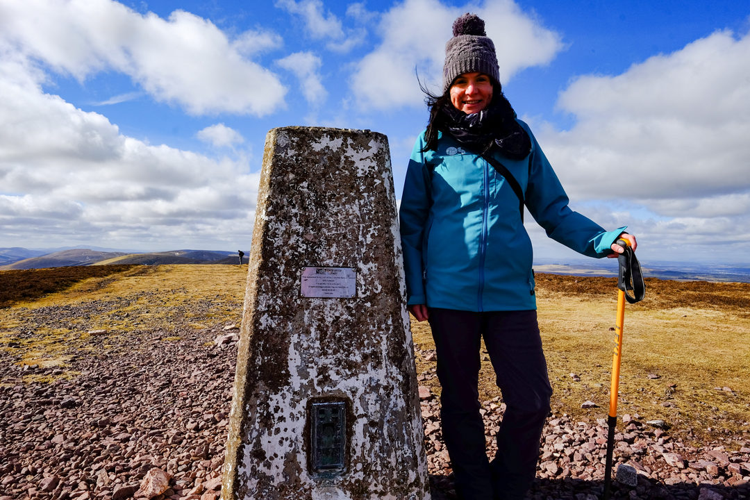
The Pentland Hills including the highest of the hills, Scald Law and can be walked in a 10-mile circular which takes in the Five Peaks of the Pentlands – Turnhouse Hill, Carnethy Hill, Scald Law and East and West Kip. This Pentland Hills walk will take around 5 hours and gives a fantastic day in the hills – and it is just outside Edinburgh.
The route starts at the car park behind the Flotterstone Inn. Head towards Glencourse Reservoir, but take the very steep path leading up over Turnhouse Hill (506m) and then Carnethy Hill (573m) which give great views back over the reservoirs, Edinburgh, andMidlothian. The path then rises up to Scald Law, the highest hill in the Pentland range at 579m.
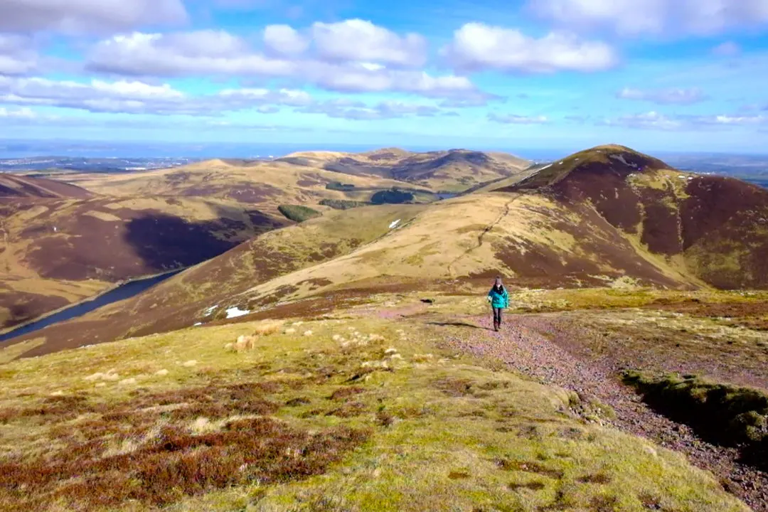
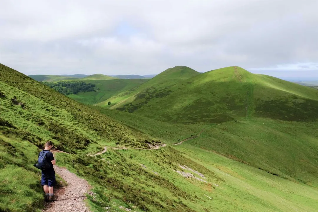
After you have taken a summit selfie it’s time to tackle East and West Kip, the shapeliest and steepest hills in the range. West Kip is often described as the Pentland’s best hill – and approaching it from the east you avoid the very steep west side ascent – honestly, even for an experienced hill walker, it is a bit of a puff!
Climb down West Kip and head towards Balerno. Before you reach Hare Hill ahead of you take the boggy path to the right. You will then reach the Logan Burn before descending down to The Howf and Loganlea reservoir. The walk returns alongside Loganlee and then Glencourse reservoirs on the road to complete the 10-mile loop.

6 / The Pentlands Skyline
Fancy the ultimate round of the Pentland Hills? Then tackle the Pentland’s skyline – the full circuit of the Pentland Hill’s two ridge lines.
From Hillend Ski Centre car park, the Pentlands Skyline route takes you first up the Caerketton, Allemuir and Castlelaw Hill before descending down to Flotterstone. Then it is up an over the five peaks in the Pentlands – Turnhouse Hill, Carnethy Hill, Scald Law, South Black Hill and East and West Kip before descending back down to the valley.
Cross to the other side and climb up and over the rough and boggy path over Hare Hill, Black Hill, Bell’s Hill, Harbour Hill, Capemuir Hill and back over Allemuir before returning to Hillend. The Pentland Skyline route is around 16 miles and takes in around 6200 feet of climbing! Phew.
- Walk start: The Regional Park car park at Hillend dry ski slope.
- Route – Skyline Route Map
- Distance – 16 miles
- Bus – Lothian Bus no. 4 to Hillend
- Park – park at Hillend Dry Ski Slope
Love, From Scotland x
How to get to the Pentland Hills Regional Park
You can access the Park from (clockwise) from Bonaly and Dreghorn off the Edinburgh City By-Pass, from the east at Hillend Country Park, Boghall, Flotterstone, Nine Mile Burn and Carlops, and from the west from Harperrig, Balerno and Currie.
Getting a bus to the Pentland Hills Regional Park
Map of the Pentland Hills Regional Park
More Scottish Borders and Midlothian Itineraries
The travel blogger and photographer behind Love from Scotland
Jessi (@2feet1world)
Wednesday 9th of August 2017
Gorgeous scenery! That's efficient climbing fitting 5 in :D